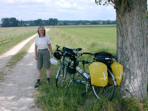
European Bike Express pickup
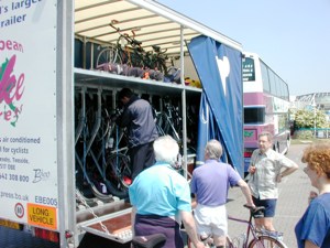
European Bike Express trailer
This was a 15 day and 950 kilometre bike ride from west to east across France, hopefully with the wind behind us. At the beginning of our journey we followed the river Charente through the Poitou-Charente region. Then we were in the Berry (or Centre) region and crossing rivers such as the Indre, Cher and Vienne that flow into the Loire to the north. We crossed the higher part of the Loire as we entered Burgundy at Nevers, then skirted the Morvan mountains as we crossed Burgundy to Autun. We then followed the Doubs (and the Rhone-Rhine canal) via Besancon and on through most of Franche-Comté. In Alsace we continued to follow the Rhone-Rhine canal as far as Strasbourg.
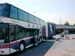
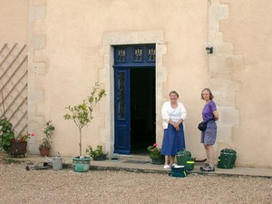
The Bike Express picks cyclists up at various points in the UK from Teesside to London - our nearest pick up point being at South Mimms on the M25. As we didn't like the look of the big interchange at South Mimms, we did some research and discovered that Sustrans route 12 goes past the back of the coach park where the pick up takes place. So we got there without having to negotiate the roundabout. (Here is an annotated map in case you want to do the same). The Bike Express consists of a smart double decker coach with a trailer for the bikes and panniers. They put the tandems in the upper deck of the trailer - another tandem joined us at Waltham Cross. At Dover we took the big P&O car ferry to Calais. They drove via the Paris péripherique to Orléans the first drop-off point where we had a quick meal at a service point. We had a bad sleep in uncomfortable seats and were dropped off at Saintes at 3.30 am. We spent the rest of the night in the nearby Premier Classe Hotel - you use a credit card to get a key card for the room. We slept well until 7.30 and had breakfast on the terrace.
|
European Bike Express pickup |
European Bike Express trailer |
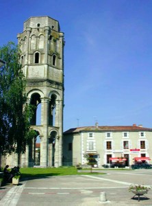
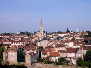
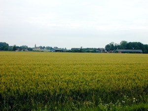
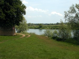
Poitou-Charentes region, Vienne department
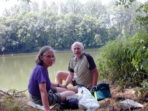
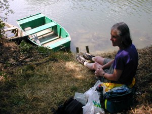
| We started early as we had about 100 kilometres ahead of us to reach Civray - where we had booked into at very good Chambre d'Hôte where we had stayed on our previous trip. Although Saintes looked a very interesting place with glimpses of a Roman triumphal arch and some romanesque churches we decided not to do any sightseeing. Everywhere seemed very deserted and we eventually found out that this was Ascension Day - a bank holiday and most shops were closed. We went via Marthe where we were luck to find somewhere open to buy our picnic food. This is in the Cognac area and we passed through many vineyards. But there were also cereal crops and beans as the day went on, there were no more vineyards. We noticed that the area has quite a number of romanesque churches and eventually had a look at a small romanesque church in the village of Bresdon. We stopped for out picnic just beyond Aigre. The afternoon became very hot and we stopped for drinks and energy bars. Then we had a good ice cream in Ruffec where a big fair was taking place. We eventually arrived a Civray at 5.15. Civray is an attractive small town on the river Charente. We soon found l'Hermitage. Victor was very friendly and we had a swim in their pool, which restored us. We walked along the riverside to have a meal at the camp site and then back through the centre of the town, which we remembered from last time, and back over the two bridges. |
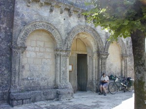 Eglise de Bresdon |
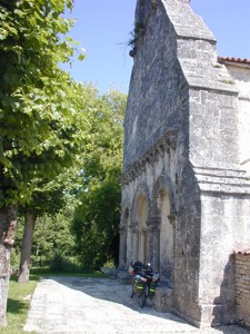 Eglise de Bresdon |
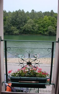
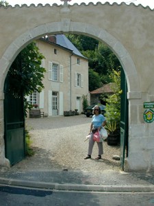 Civray: l`Hermitage (in 2000) |
 Civray: l`Hermitage |
 Civray: l"Hermitage |
Distance today: 97 kilometres
Chambre d'Hôte: Civray, Miki and Victor Goudsmit, l'Hermitage
05 49 87 17 95. Price €45
Poitou-Charentes region, Vienne department
|
|
||
|
|
Distance today: 73 kilometres
Chambre d'Hôte: Montmorillon, M.Ydier, Boubrault. 05 49
91 85 92. Price €35
Etrechet is in the Centre or Berry region, Indre department
|
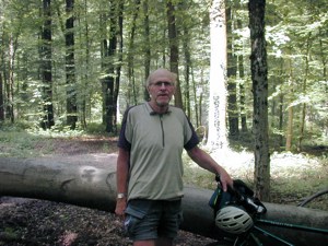
We had planned to spend the night somewhere on the river Indre before Chateauroux, but being a Saturday bank holiday evening, we had to phone many Chambre d'Hôtes before finding one at Etrechet beyond Chateauroux. Fortunately it does Table d'Hôte. This day started very hot and continued to be so. We set off via Montmorillon to Bélabre. The road ran alongside a military area, so there are no crops, just grassy fields and trees. Bélabre is a very attractive village on the slopes above a river and we bought our usual baguette, pate, cheese and fruit for our picnic. We continued along a very tiny road as far as the Chateau Ronfort which is on the bank of the river Creuse - it is privately owned and no visitors are allowed. But you can sit in a park on the opposite bank and look at the view - that's where we had our picnic. We continued through the Regional Park of la Brenne - a big area with thousands of étangs - originally made by monks to breed fish and still used for fish farming. This area is marshy, with low trees, very narrow roads and few cars. There are villages with interesting feaures, for example, Ciron has a Lanterne des Morts - a round hollow chimney like tower on a platform which is supposed to contain an everlasting light. The Chambre d'Hôte at Etrechet was interesting. It is a big 18th century house with a large garden. The garden is simple - a lerge lawn and big trees, very comfortable and shady to sit in. Mme Lyster has an English husband and had lived in England for 40 years. She talked a lot, but manged to serve us with a good meal. The other guests who were from Rouen advised us to visit Noirlac the next day. We asked about the particular characteristics of the Berry region, but the replies were rather vague: it is at the centre of gravity of France, Georges Sand lived there, they do agriculture and have many chateaux . As to the cuisine: they have carp from la Brenne, galette (puff pastry pie containing potatoes). As we went on through the Berry we wondered whether the difficulty in describing its characteristics was symptomatic, it didn't seem as interesting as the other regions of France. |
|
Distance today: 90 kilometres
Chambre d'Hôte: Etrechet, Mme Lyster, les Menas. 02 54 22
63 85. Price €46
St. Amand Montron is in Centre or Berry region, Cher department
|
We had some trouble booking a Chambre d'Hôte, either near Chateauneuf sur Cher or at St. Amand Montron, so we decided to go via Noirlac and then look for a hotel on arrival at St. Amand Montron.We had a good breakfast and then cycled off via Etrechet, following a canal and passing by maize fields and a few woods, over an almost flat landscape until we reached Chateauneuf sur Cher. The Cher flows into the Loire, as do the Vienne which we saw at Ile Jourdain and the Indre that we saw near Chateauroux. We then took a very attractive scenic route by the river Cher, having a picnic beside the river. It seems to get hotter every day. We visited the Abbaye of Noirlac which was very worth while. We then went on to St Amand Montron where it was hard to find a hotel and the tourist office was closed. The first hotel didn't work on Sundays, the next was full and told us that no more beds are available in town (and tried to book us into one about 8 kms back the way we had come). But eventually we did find a rather dingy hotel with a bed and decided to stay there. We went to a bar in a dull square and asked about restaurants. They were not much help, but we did eventually get a cheap meal in a basic place (the only disappointing meal for the entire trip). Having eaten we wandered around some more and found an old area of town and another nicer bar. On the whole we found St. Amand rather dull and the Berry a bit boring. |
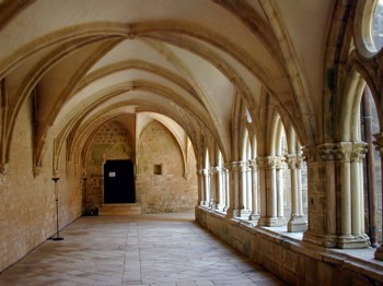 The cloisters at the Abbaye of Noirlac The cloisters at the Abbaye of Noirlac |
Distance today: 71 kilometres
Hotel: St Amand Montron, Hotel Croix d-Or. Price €50 plus
breakfast
Nevers is in the Bourgogne region, Nievre department
|
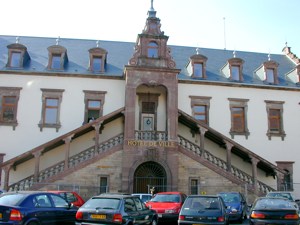
From this day on, we made early starts (well.. about 8.30 am) so as to do 50 km before lunch time and before it became too hot. But this time it had rained in the night and was not so hot! Today's target is Nevers which is on the river Loire itself and on the border of the Bourgogne region. We were cycling in the rain all morning but the waterproof tops proved to be OK. We stopped for a hot chocolate and a dry off in Sancoin. We then went on to Apremont which is on the river Allier, which joins the Loire near Nevers. We had known nothing about Apremont - it is a perfectly preserved mediaeval village and it was very exciting to stumble upon it. It had been a mediaeval quarrying village that supplied stone which was transported via the rivers Allier and Loire to Orleans and other places. It was restored in the 1930s. It has two parallel streets of old houses with stone walls and tiled roofs - probably 15th -16th century. A chateau overlooks the village. We followed the Allier to where it joins the Loire at Bec d'Allier. Nearby is the big canal aqueduct that brings the Canal lateral a la Loire to join the Allier. The landscape here is on a smaller scale, more interesting, with hedgerows. The crops are still mostly cereals but there are a few sheep. Although the rain had stopped, it was too wet to picnic, so we had lunch in a bakery near Nevers. The approach to Nevers is spectacular - first there is the view of the giant gothic cathedral standing over the town, then you cross the bridge over the Loire and then go up a hill and straight into the old part of the town. The Tourist Office is in a glass shelter on the side of the Ducal Palace - they recommended the nearby Hotel Cleves, where we booked in. We put the tandem in the yard, changed our clothes, and put the socks and shoes (stuffed with pages from Figaro) to dry. The weather was now fine and there was no more rain. We followed the blue line that helps tourists to find all the interesting sites in Nevers. This took us to the Ducal Palace, down to the riverside, past the old ramparts and on to the cathedral. We visited the cathedral with its giant gothic nave and romanesque apse. We then followed the blue line again through the pedestrian areas. We had an evening meal at Bacchus - this restaurant offers a set price meal for €21 including 3 glasses of wine. The sommelier selects the wine to match each of the three courses. He and his wife run the restaurant. The food was good and the wine excellent, particularly a Touraine cepage 'Gamay' 2000.
|
 Apremont sur Allier
 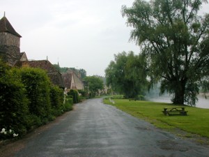 Apremont sur Allier
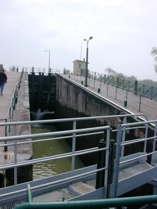 Canal aqueduct near Nevers |
Distance today: 68 kilometres
Hotel: Nevers, Hotel de Cleves 8, rue, St. Didier, 58000, tel.
03 86 61 15 87. Price €39 plus breakfast
Bourgogne region, Nievre department
|
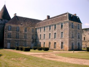
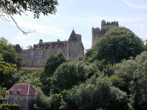
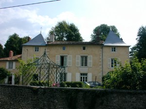
We chose Fours as our next destination, as it is midway between Nevers and Autun and has a Chambre d'Hôte with a swimming pool that provides an evening meal. As usual we had a cool morning and warm afternoon. We left Nevers on the south side with a view to following the canal lateral à la Loire as far as Décise. We tried the towpath for some of the way, but found it rather bumpy. We had seen this canal the day before where it crossed the Allier on a big aqueduct. Décise is a small country town on a hill above the Loire. We bought our picnic there and eat it by the river. We then rode on to Fours following the valleys of the rivers Aron and Alene. Unfortunately this was a fairly busy road and there seemed no easy way of avoiding it. Fours itself is a bit like a small commuter town. There is a central square with a church and most of the usual shops. But the remaining houses are mainly strung along the mian road. However, the Chambre d'Hôte was just off this road and proved interesting. It is called Chateau Latour. It's scarcely a chateau but is a fine Georgian style stone house built in 1720 with a slate roof. A bonus is the big swimming pool where we were able to cool off on our arrival. The people who run it also have a brocante as well as several fields, with chickens in the garden and goats in the field. M. Petillot let us look round all the junk in his barn, which he sells to Dutch people who buy houses in the area. We had a good Table d'Hôte meal during which a big storm blew up - rain was coming in through the windows. |
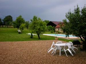 Fours: Chambre d'Hôte
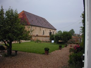 Fours: Chambre d'Hôte
 |
Distance today: 58 kilometres
Chambre d'Hôte:Fours, Mme Petillot, Chateau Latour. 03 86
50 20 15. Price €44
Autun is in the Bourgogne region, Saône et Loire department
|
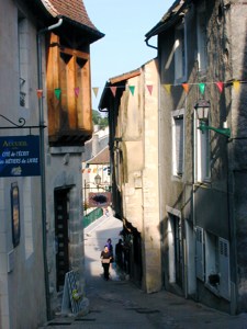
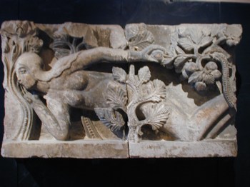
Another fine day, that became very hot by the afternoon. To avoid the main roads, we took the hilly side roads along the edge of the Morvan Regional Park, passing through villages and farms - we even had to wait for a herd of cows to go down the road. We saw a spotted woodpecker (Pic épeiche) and several big brown hawks, one quite close up.The ride into Autun is good - up a hill and into a square (champ de mars) where we had a picnic lunch. The Tourist Office is nearby and they told us about the Hotel Tete Noire nearby, which we booked into. Autun is surrounded by wooded hills above the valley of the river Arroux. The centre of Autun has many narrow streets, lined with old houses. The Rolin family were famous in the middle ages, the best known member being a lawyer in the 14th century. We walked through the pedestrian area to see the cathedral. Our photographs of Autun are here. The Musée Rolin was very well worth the visit. They have a collection of roman mosaics and sculpture and many early paintings including a nativity with Rolin attending, by the Maitre de Moulins (Moulins is to the south of Autun). In addition there is a collection of local impressionists and post impressionists - including Louis Charlot - and a watercolourist (Maurice Denis - nice pink paintings). But the best thing in the collection was the mediaeval stone carving of the temptation of Eve by Gislebertius. We sat by the fountain outside the cathedral for a drink and then went on to have a meal in a creperie in rue de Banc next to the Musée Rolin. It rained hard so we sat inside to eat. When the rain stopped we went for a walk round the Roman Ramparts. |
|
Distance today: 55 kilometres
Hotel: Autun, Hotel Tete Noire. Price €52 plus breakfast
Seurre is in the Bourgogne region, Cote d'Or department
|
We went to look at the Roman gate (Porte St. André) on north side of Autun and then set off to our next destination: Seurre. We chose Seurre as it is midway between Autun and Besancon and is on the banks of the river Saone. The choice of a route was somewhat tricky as we aimed to pass between the towns of Beaune and Chalon-sur-Saone, avoiding all of the major roads in that area. We started out on the main road to Beaune but soon turned off onto the minor roads in the hills to the south of it, aiming first for Chagny. It was very hilly, but nice countryside with white cattle. Then, after two hours we entered an area of vineyards, which continued as we made the circuit round Beaune. More hawks are soaring overhead. As we approached the Saone valley, the land gradually became flatter and the villages more southern in character (although we are going east). By now we were getting hungry, but couldn't find any woods, so we picniced by a tree on the edge of a field. On our trip in 2000, the fields of sunflowers were a frequent feature of the landscape. It's too early for them to flower in June, but we did see some sunflower plants today. We stopped again in the small village of Ecuelles on the Saone and watched the river flowing and a barge pass by. It's very hard to do the last 10 km when it gets so hot. The Chambre d'Hôte at Seurre is a big house built of narrow red bricks with a slate roof. opposite the bank of the river Saone. The family were very friendly and gave us useful advice as to the route and the fact that another bank holiday is coming up (Pentecost) and booking may be hard again. Unfortunately their conversion of the inside of what is a fine old house was a gross over modernisation. We had an excellent meal at 'Au Bon Accueil', close to the Chambre d'Hôte. This is excellent bourgeoise cuisine (crudités, pintade, fromage blanc and chocolate mousse). |
 Ecuelles: where we rested by the Saône Ecuelles: where we rested by the Saône |
 Seurre: view from the Chambre d'Hotes |
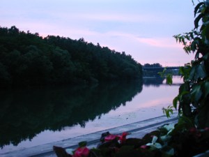 Seurre: sunset by the Saône |
Distance today: 77 kilometres
Chambre d'Hôte: Seurre, Mme Vernay,15 Quai du Midi. 03 80
20 46 32. Price €40
Besancon is in the Franche-Comté region, Doubs department
|
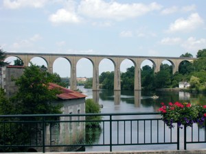
We set off early from Seurre to cross the last part of Burgundy, between the valley of the Saône and that of the Doubs, which we joined at Dole. The land was surprisingly flat with lots of villages. We chose to go via Dole so that we could cross over the river Doubs and use the very small road on the south side beside the forest of Chaoux - which proved to be very attractive with the river on one side and the forest on the other. We found a pleasant picnic place by the riverside. We crossed back to the north side at Roset with a view to cutting off a big curve in the river. We tried the towpath of the Rhone-Rhine canal, which was in good condition for a short distance, but then suddenly became very rough. We then had to backtrack a bit so as to join a suitable road. We should explain that the river Doubs is navigable in this area and plays a role as a part of Rhone-Rhine canal for some of its length. We managed to follow the north bank of the river on a small road until almost into Besancon, where we had to climb a long and very steep hill to go over the bridge and into the town. We found the Hotel Granvell quite quickly - we saw another tandem in the shed and later on met its owners Mark and Sue from Portland Oregon. We had a meal with them inthe restaurant Polonaise. On our first evening we walked in the pedestrian area, along Grand Rue and to the 8th September Square. We saw the chateau Granvell (a 16th century family made famous by a father of humble origins who became a notary and his son who was a doctor and lawyer, a parliamentary adviser and chancellor to Charles 5th. We walked out over the Battant Bridge and looked back at the long rows of grey stone houses on the river front. |
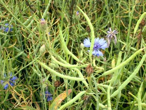 Rape and cornflowers
 |
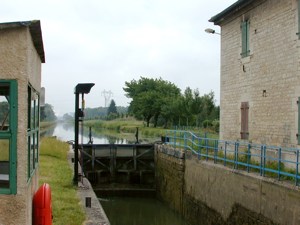 Lock on the Rhône - Rhine canal |
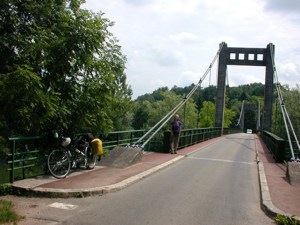 Roset: Bridge over the Doubs |
 Roset: Bridge over the Doubs |
Distance today: 92 kilometres
Hotel: Besancon, Hotel Granvelle, 13 rue Lecourbe. 03 81 81 33
92. .Price €46 plus breakfast
|
This was our day of rest. We had a lazy start and then went up to visit Vauban's Citadelle, high above the Doubs. We walked around its ramparts, getting views of the town and river from various angles. On the way down, we visited the mainly romanesque cathedral which contains a painting by Fra Bartolommeo. In the afternoon we went to the Tourist Office, which is over the Pont de la Republique to get information about places to stay in Montbéliard and the location of a bike shop, where we bought some brake blocks. The brake blocks replacement was the only work done to the tandem for the entire trip. As this was a very hot day, we enjoyed the air conditioning in the Toursist Office while we were reading their information The Musée of Beaux Arts and Archaeology is entered via a building with a classical facade, but the gallery is in a concrete building with ramps and landings built by a pupil of le Corbusier. The ground floor had a temporary exhibition of paintings of Mao by a Chinese artist. Above this was a very good collection of early paintings including Bellini's Drunkenness of Noah, and some Cranachs. A local collector (a communist called Besson) had donated a big collection of Impressionists including some good locals (Marquet and Andre) together with Renoir and Braque. It was very hot and humid in the museum, so when we left, we sat in the Square 8th September with a cool drink watching the passers by. This square is a very busy, with cafes, a carousel, buses and occasional posers in noisy cars - then a wedding party came out from the Town Hall. |
|
Hotel: Besancon, Hotel Granvelle.
Franche-Comté region, Doubs department
|
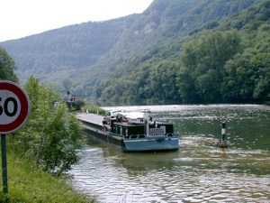
The river Doubs continues from Besancon to somewhere near Montbeliard, where it bends round to the south. We rode along the small road beside the river on the south side. This route is spectacular, particularly the first half where the valley is narrow and steep - with cliffs and forest beside us. We saw holiday cruisers on the river and in the locks. We had to cross to the other side and use the N road for a few short stretches when the minor road ran out. We found a lovely place by the river for our picnic. Where the Doubs departed to the south, we followed the Rhone-Rhine canal canal into Montbeliard on a pleasant road. The Hotel de France which is beside the canal is a big german style 1930s stone house, generouasly designed with wrought iron and stained glass. We took a footpath that followed the railway bridge over the canal and river into the centre of the town which was rather deserted - probably because it was a Sunday evening. There are some interesting old buildings here: a big chateau of which only two towers remain, several renaissance stone buildings by Schickhart (Hotel du Beilli and Maison des Princes), also a very fine big stone Lutheran church. But the town is rather spoilt by shops (specially in the les Halles area) and cars. Only one restaurant was open - we had Tartiflette Savoyard. Our photos of Montbéliard are here. |
 By the Doubs 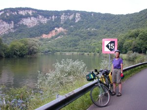 By the Doubs |
 Picnic by the Doubs |
 Picnic by the Doubs |
Distance today: 84 kilometres
Hotel: Montbéliard, Hotel de France, route d'Audincourt.
03 81 90 21 48. Price €40
Cernay is in the Alsace region, Haut-Rhin department
|
Rather than going straight along the centre of the Rhine valley to Colmar, we decided to head for the foothills of the Vosges to see the Route du Vin and to spend the night near Cernay. We made a lazy start, following the Rhone-Rhine canal, the first 7 km on the towpath. This is a well-paved track called the Coulée Verte and used for family bike rides. We went past the vast Peugeot factory on the other side of the canal, where hundreds of new cars were lined up. We turned away from the canal at Montreux Chateau and entered the Alsace region. Here there are numerous small villages with German names and nice countryside between them, growing maize and potatoes, as well as beach woods. The houses in this area are half-timbered, with steep roofs, German style. We saw storks flying. We had our picnic in a beach wood and then went on to Burnhaupf le Bas which was having an immense fair - the road was marked as barred but we decided to walk through, little knowing that the stalls and other activities would stretch for a long way and prevent us from taking the turning we wanted. This meant that we had a lot of trouble getting past the pair of A and N roads in our route. Eventually we escaped onto a small road and into Cernay. The Chambre d'Hôte at Uffholz is a very pleasant and peaceful place. They have three purpose-built rooms facing a private garden, each with kitchen and bathroom. We sat in the garden reading and our host gave us cherries and strawberries grown in their garden. The father of the host suggested that we should visit Neuf Brisach on the way to Colmar. We walked back to the nearby centre of Cernay past a large war grave cemetry. Most of the graves were from the first world war, when the French were involved in many battles in the attempt to reclaim Alsace, which had been taken by the Prussians in 1870. Large parts of Cernay appear to have been rebuilt recently. It's a pity it was a Bank Holiday and all the shops shut, or we could have made our own meal. Although this is supposed to be on the route du vin, we haven't seen any vineyards yet. We had a buffet meal at a place near the Chambre d'Hôte. We noticed today that people are talking alsacien, which sounds like German but with a few French words. |
 Picnic spot in beach wood on the way to Cernay 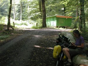 |
Distance today: 56 kilometres
Chambre d'Hôte: Uffholz, Bernard, 25 rue de Soultz. 03 89
39 91 27. Price €40
Alsace region, Haut-Rhin department
|
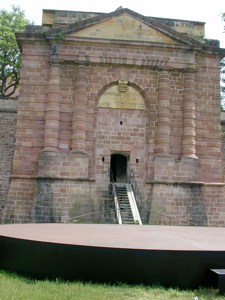
We had a very early breakfast in the garden and made an early start to allow for our detour to Neuf Brisach, which is close to the Rhine to the south east of Colmar. We followed the route du vin as far as Soultz and we did see plenty of vineyards on the foothills of the Vosges. These are the tall, Y-shaped vines, sometimes with rose bushes at the end of the rows. They advertised Alsace crémant wines. Soon after Soultz we left the route du vin (which continues northwards past Strasbourg) and set off across the Rhine Vally to Neuf Brisach. This valley is very flat and mainly seems to grow maize. The many villages have German names and big semi-detached houses. The detour to Neuf Brisach was very worthwhile. It is a Vauban fort with an octagonal plan surrounded by a sixteen-point star. There is a (dry) moat between the two parallel octagonal walls. The town has a central square from which the four gates can be seen - two are intact but the others were destroyed during the occupation in WW2. Neuf Brisach was bulit in 1697 - Louis 14th had been fighting many of his european neighbours and had been forced into a treaty at which he agreed to give up Old Brisach on the eastern side of the Rhine. He needed a new fort to protect the resulting weak point. Vauban made a 30 km canal to collect stone from the Vosges. This is a bowny-red stone - the same as in the churces in this area (e.g. Soultz and Colmar). We entered by the Belfort gate, then went to the centre to a very helpful tourist office who knew about cycling, giving us a map of routes nearby and selling us a map of bike routes in Alsace. We then cycled round the moat and had a picnic by the Colmar gate. We followed the cycle route towards Colmar across the flat valley. When we arrived, we booked into the Hotel de la Ville de Nancy on rue Vauban just where the pedestrian area starts. Then we went to see the town The centre of Colmar consists of a large pedestrian area, containing a stunning collection of early17th century merchants houses. The facades of these houses have dark timber beams and coloured plaster as well as wooden shutters. They are usually highly decorated. On emerging from the Unterlinden museum we were too hot to walk (37 ºC) so we decided to take a trip round town on the tourist train to see the sights, which included the cathdral and an area called Little Venice. We then stopped by the Maison des Tetes for an ice cream. On the way back to the hotel we watched a demo by the CGT union - there are currently many strikes in France against the governments new pensions proposals. When it cooled down a bit we went for a meal of choucroute garni - an ubiquitous dish in this town - we wonder where they grow all the cabbages. |
 Soultz
 Soultz |
 Neuf-Brisach: Port de Belfort |
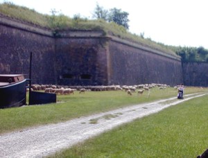 Neuf-Brisach |
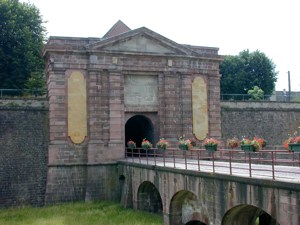 Neuf-Brisach: Porte de Colmar |
 Neuf-Brisach: Picnic |
Distance today: 62 kilometres
Hotel: Colmar, Hotel a la ville de Nancy, rue Vauban. Price €50
+ breakfast
Alsace region, Bas-Rhin department
|
We would have like to follow some more of the route du vin, but due to the heat and the distance, we decided to take the shortest route. This was shown on the cycle route map as a cycle route on minor roads which joined the towpath of the Rhone-Rhine canal for the last 30 km into Strasbourg. The route was signed as far as the canal, and even better, the towpath is beautifully surfaced all of the way to Strasbourg. The latter was a very peaceful route, straight and level with picnic places along the way. Eventually we arrived near the centre of Strasbourg, seeing a major road on the other side of the canal. We turned off from the canal by the hospital onto a cycle track that runs alongside a river, ducking under bridges from time to time. After a short distance, you come up to road level and take a cycle lane towards the centre, crossing two roads. Then you are in the pedestrian area and arrive in the square in front of the cathdral. The cathedral faces the square, it is the biggest and most impressive we have seen, built of the red-brown Vosges stone and covered in sculpture. After getting the information from the tourist office, we tried several hotels near to the centre, but eventually had to settle for the Continental near to the railway station. However, this was a good choice as they were very helpful about storing our bags and tandem the next day. Our photographs of Strasbourg are here. We walked back to the cathedral square via Petite France, which is an old area of timbered merchants' houses by the water, one of which is the Tanners House. We then passed by Guttenburg square - Guttenburg lived in Strasbourg for 10 years while he was developing the printing press. After a visit to the cathedral, we had a meal in a restaurant nearby - J had Baekehoff (bakers oven) - a stew of potatoes, onions, carrots and 3 meats in riesling and G had confit de canard. Strasbourg has hundreds of cyclists, marked lanes, cycling signed as allowed in pedestrian areas, contraflow in 1-way street outside the hotel. Pedestrians and cyclists seem to coexist also cars and cyclists.
|
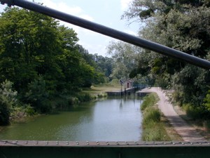
 Cycle track by the Rhône - Rhine canal |
Distance today: 74 kilometres
Chambre d'Hôte: Strasbourg, Hotel Continental, rue Maire
Kuss. Price €70 including breakfast
Usually when we have a day off, we leave the bike behind. However, Mark and Sue had given us a detailed map of the cycle routes in Strasbourg (also available at the Tourist Office). So we decided to use the bike to go out to see some of the sights outside the centre. The European Parliament and Court of Human Rights are situated by a stretch of river on the east of the town. The latter building is deisgned by Richard Rogers.
We went to see the bridge over the Rhine, going over into Germany. Unfortunately they are redesigning the park by the riverside so we were unable to go in there.
In the afternoon we explored the centre of Strasbourg on foot, spending some time admiring the cathedral, particularly its sculpture and stained glass. The Musee de l'Oeuvre de Notre Dame nearby was used as an office by the mediaeval designers of the cathedral. It contains the originals of many of the sculptures from the cathedral, which were replaced by copies early in the 20th century to avoid pollution.
On the way back to the hotel, a big thunderstorm suddenly happened, so we sheltered in an art gallery for an hour or so. Then it cleared up and we cycled to the point to the south west of Strasbourg to wait for the Bike Express. This involved using the same canal track we arrived on, and then turning off onto another cycle route to the destination at an out-of-town road junction with the usual collection of hotels. We had a meal in the Ibis and then waited with a few other UK cyclists until midnight to be picked up.