Provence with the Train des Pignes
Introduction
-
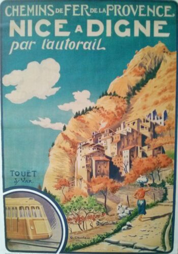
- 1935 poster
-
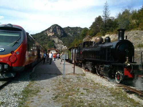
- Ancient and modern trains
Click on any photo to get a quick blow-up.
A slideshow with 160 photos of our trip is available here.
September 16th – October 2nd 2014
We wanted to spend time walking in the French Alps, but to find something easier than the last two years’ refuge-to-refuge walks in the Vanoise. With a late September visit we wanted an area fairly far south. The Alpes de Haute Provence looked promising with villages at 700-800m to stay in providing access to walks on paths going up to about 1300m. We had heard about a ‘little train’ that runs from Nice through this area to Digne and saw that it would provide access to these villages for places to stay and for getting to walk starting points.
We travelled from London to Nice by Eurostar and TGV, changing trains at Lille. We arrived in Nice at about 9pm, having taken the 9am train from St Pancras and incorporated a long wait at Lille.
On the return we travelled by bus from Digne to Gap, stayed with friends in Hautes Alpes for three nights and then returned from Grenoble to London by TGV and Eurostar changing in Paris.
 Train des Pignes
The ‘little train’ is run by a company named Chemins de Fer de Provence and is now called the Train des Pignes (maybe because pine cones were used when there was a shortage of coal).
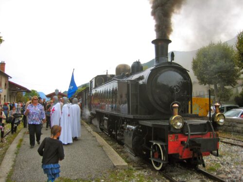
This is a narrow gauge (1 m) single track railway that opened in the 1890s. There are five trains a day each way. At weekends in the summer, a very popular steam train runs on the line between Puget Theniers and Annot.
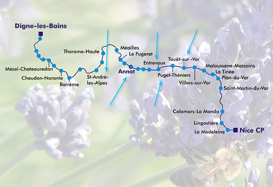
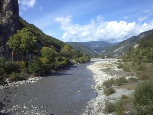
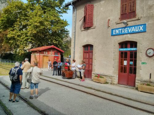
On leaving Nice, the train runs through the streets of Nice like a tram, going steeply up from sea level and travelling through tunnels into a narrow mountain valley, following the river Var as far as Entrevaux.
The stations we used all had murals in the ticket office showing the railway in the context of that particular place, for example, Entrevaux showed the drawbridge and gate into the town.
-
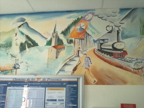
- Mural at Entrevaux station
-
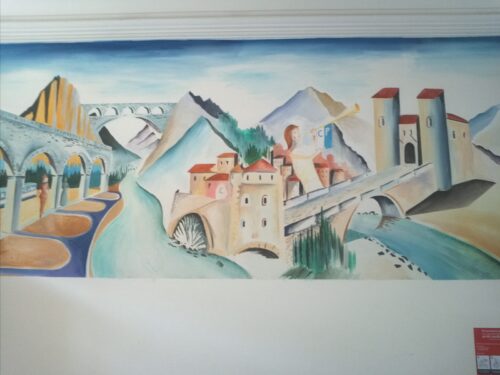
- Mural at Entrevaux station
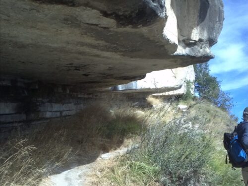
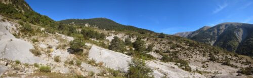
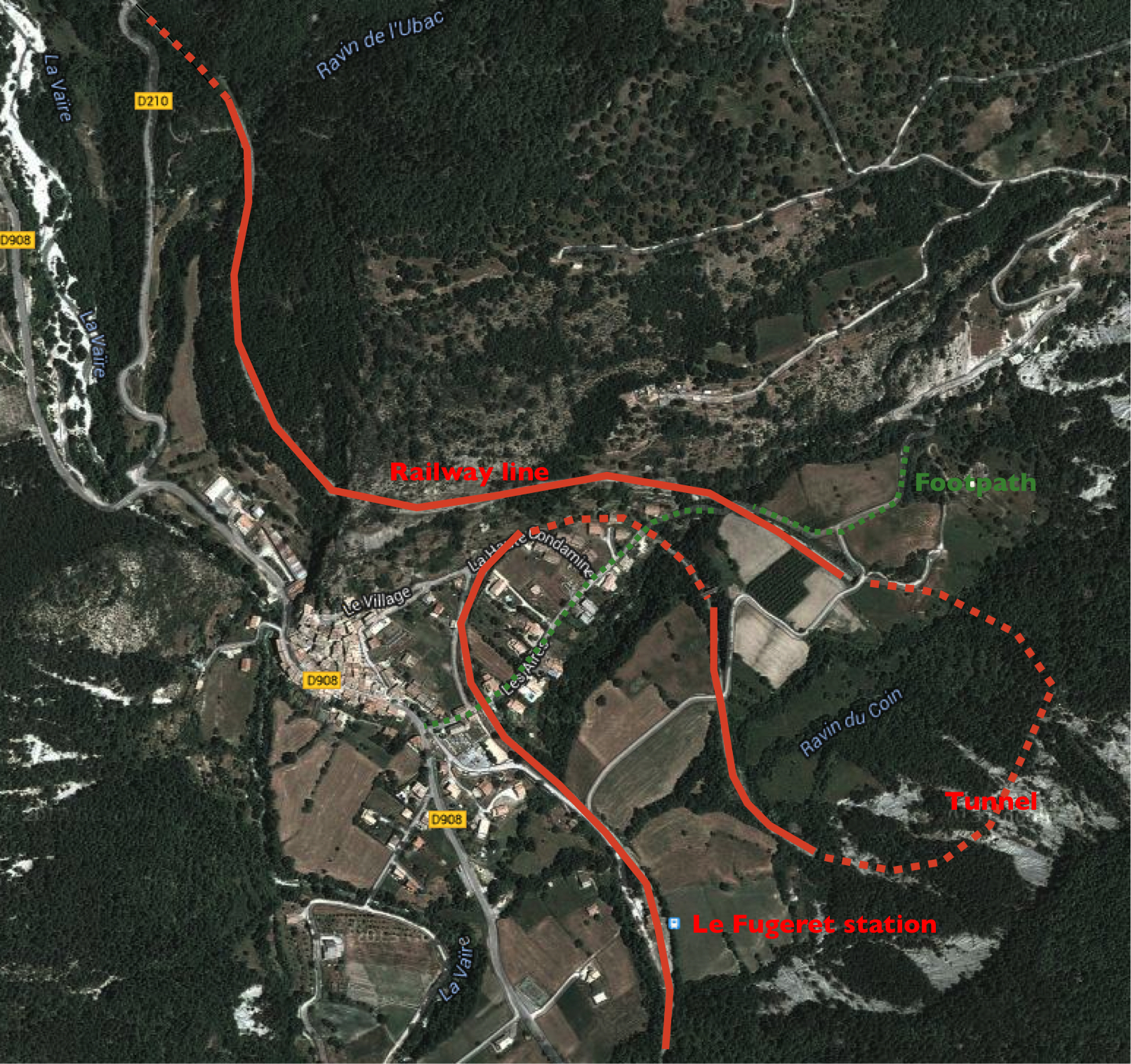 The engineering is impressive since the route through the mountains involves tunnels and embankments. We were particularly impressed by the way the line climbed up from the station at le Fugeret via a pair of loops (using cuttings and tunnel and an embankment) before entering the tunnel to Méailles – image on left. On coming down the footpath from above le Fugeret we walked under a high viaduct holding the railway line. A little further down the path, we crossed over the line in a cutting. The third time the two were level.
The places we stayed (including accommodation)
Nice
-
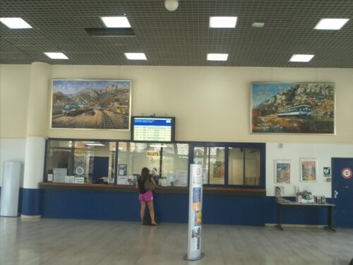
- Nice Train des Pignes Booking office
-
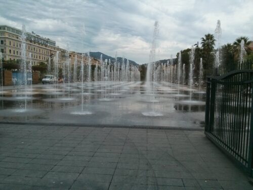
- Nice: Place Mesina
We decided to spend two nights in Nice so as to have time to fit in a swim in the Mediterranean. We had forgotten about lack of sand on the beach – getting in over stones was quite hard but the sea was warm and the swim enjoyable. But scrambling out over a steep hill of stones was very painful and difficult.
In the afternoon we went up to the Cimiez area where the Matisse Museum is inside a park containing the remains of a Roman arena.
Accommodation: We stayed in a studio in a pedestrianised area (rue de France) just two blocks from the beach and from Place Masséna – found via airbnb.co.uk. The owner Michele picked us up from Nice station and took us to the room and provided us with lots of helpful information about our stay.
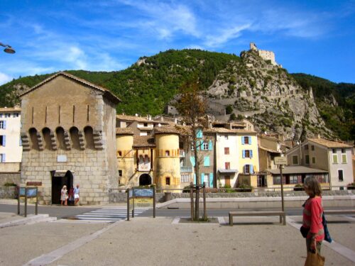
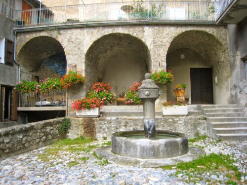
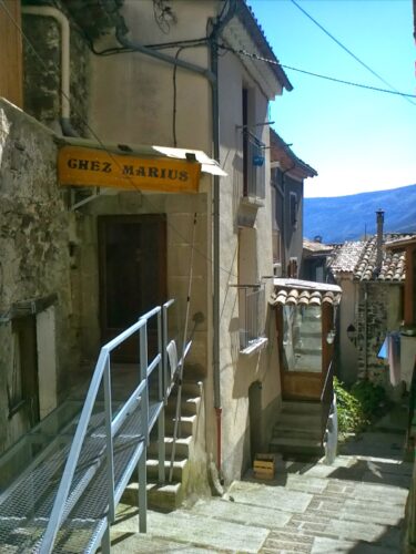
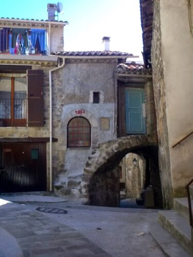
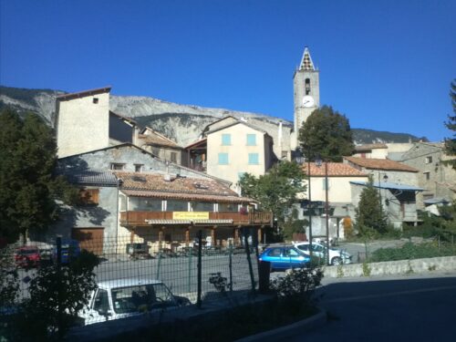
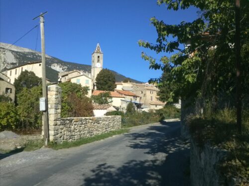
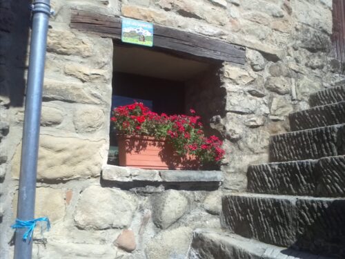
Entrevaux
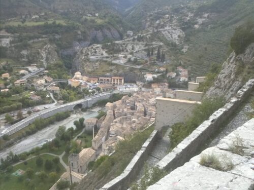
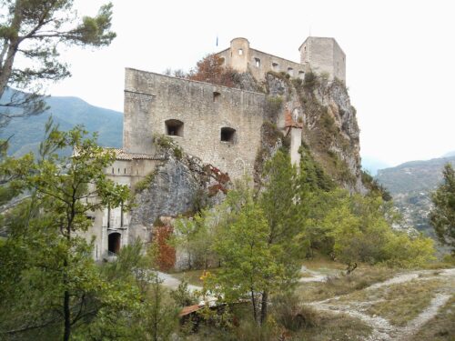
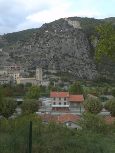
We took the 13:05 Train des Pignes which starts from Nice CP (Chemins de Fer de Provence) station. This is an attractive little station with murals illustrating the journey of the little train as it runs up to Digne. The journey to Entrevaux took about 1.5 hours. The station at Entrevaux is close to the drawbridge over the river Var and the fortified entrance to the old walled town through the Porte Royale. Above all that, sits the immense Citadelle of Vauban.
-
- Entrevaux from across the river
-
- Entrevaux and mountains seen from the Citadel
-
- walk to Les Lac: Approaching Citadel from the rear
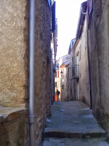
-
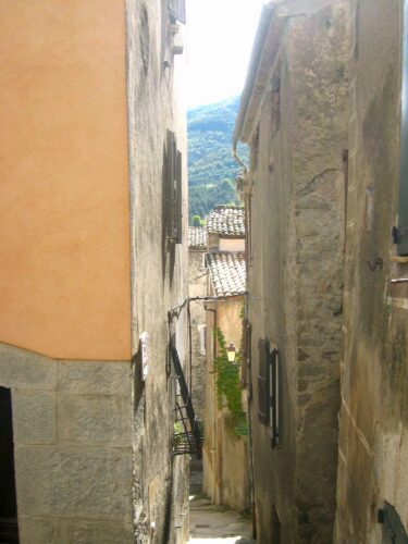
- Alleyway
-
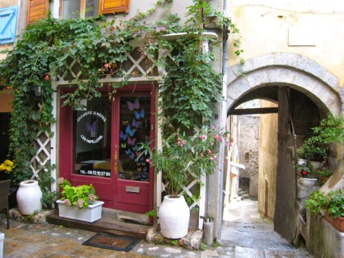
- Les Papillons. B and B
-
- Entrevaux
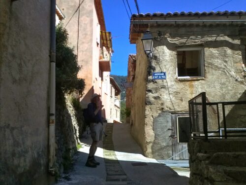
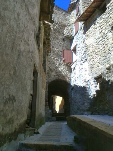
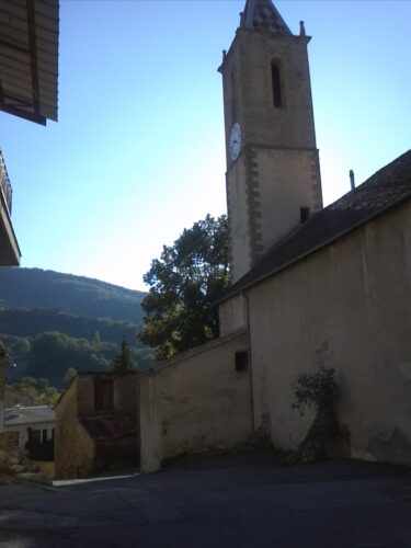
We enjoyed wandering around the town inside the walls, following the narrow passages paved with volcanic stone and lined with tall houses. A large 17th C cathedral with a tower is next to the Porte d’Italie at the eastern end of the town. This exit leads into a little square with a plane tree shading a bench where the local pensioners sit and chat. Beyond the square is a footpath heading east above the valley of the Var.
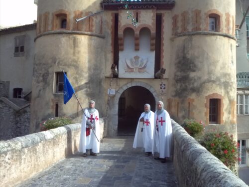
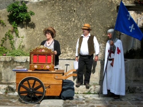
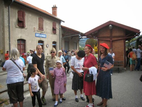
There are no cars inside the walls and at this time of year, few tourists. Our weekend at Entrevaux coincided with the national Jours de patrimoine, which provided an excuse for many of the local residents to don period clothing and bring some ‘animation’ into the streets.
-
- Chevaliers
-
- Patrimoine
-
- Four banale
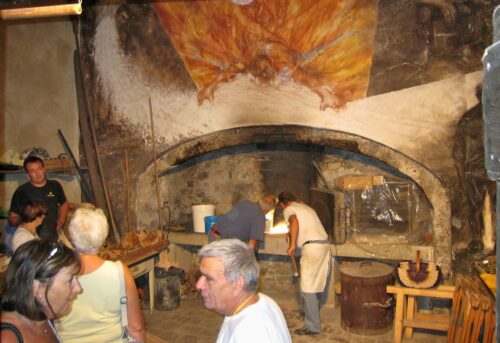
History: In Roman times, the town was on the south side of the river, but in 11th century, the walled town of Entrevaux was built on a rocky spur on the north side to provide a more defensible position together woth a citadel perched inaccessibly on a rocking crag high above. In 15th century, the local people defended the town against the Holy Roman Empire, giving it to the King of France – they were then awarded a charter and exemption from taxation (until the revolution). In 1692 Louis 14th commissioned Vauban to reconstruct the citadel so as to increase the fortifications, resulting in the immense Citadelle that looms above the town with an impressive steeply-inclined paved switchback pathway enabling horses and artillery to reach it. In the 19th century when the county of Nice was in Savoie, Entrevaux was very close to the border of France and again important for defence.
Accommodation: We stayed five nights in Les Papillons, chambre d’hotes in the Place du Marché in the centre of the walled town. We had an immense room with red tiled floor, big bed, spacious bathroom and plenty of storage space, on the top floor accessed by a winding staircase with rope handrails. Our hosts Nathalie and Florent were very friendly and helpful, inviting us for a meal with them on our last night.
Eating: We were pleased to discover the Crêperie du Chevalier with outside tables in a narrow street. The chef, Claudine uses traditional batter for the galettes and crêpes and adapts them to use local products (e.g secca a sort of Provençale salami made of dried beef).
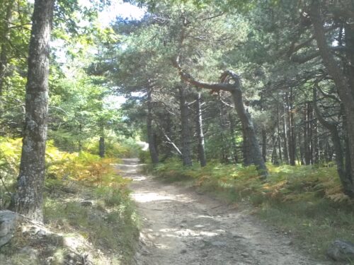
Walks: The long distance GR 4 route runs from the west coast of France through the Alpes de Haute Provence at Entrevaux and on to Grasse. This links up with the GTPA (Grande Traversée des Pré-Alpes) waymarked in red and yellow. While in Entrevaux we didn’t follow either of these, but did two walks on local paths:
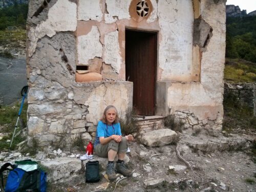
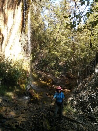
- to Les Lacs a circular route of about 8 km starting from Porte d’Italie, following the path above the Var, turning up a chemin to the hamlet of Les Lacs (no lakes but a small farm and terraces and many ruined houses) and then returning on a higher attractive path through woods (pines and oaks) on path via the Citadelle. We had a picnic by a little chapel above Les Lacs accompanied by strong smells of thyme.
-
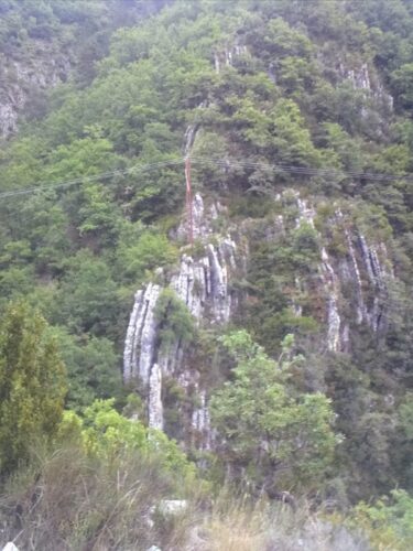
- walk to Les Lac: Rock strata
-
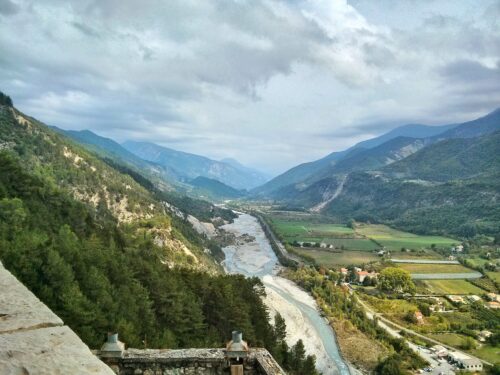
- View of var from Citadel
-
- walk to Les Lacs inside ruined chapel
-
- walk to Les Lacs picnic at ruined chapel
- to Le Brec a there-and-back route of about 9 km, starting from the Porte de France which leads to a steep path down to the left bank of the River Var heading west. There’s a big swimming lake by camp site at Le Brec but only residents of the campsite are allowed to use it. On this hot day it would have been delicious to dive in!
The Var from Chemin de France
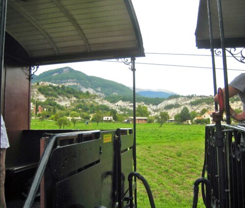
Train à vapeur: we were lucky to get last-minute tickets for the Sunday outing on the steam train. It was very impressive with an engine and carriages from around 1910 that were probably used on the line at that time. Since it was also a Jour de Patrimoine, some local got up in costumes of various periods, e.g. a GI and floosies from WWII.
-
- GIs
-
- Train a vapeur
-
- Entrevaux station
-
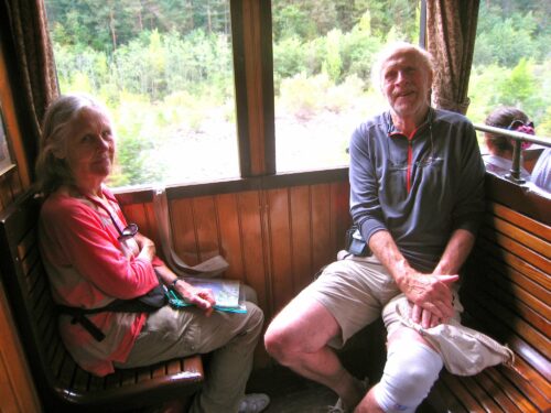
- G and J in train
-
- Train a vapeur
-
- Train a vapeur
The ride was a lot of fun. It took us to Annot on a journey through tunnels and along the scenic valley of the Var and VaÏre for about 45 minutes. We had time there for a look around the village before the return journey 3 hours later on the same train.
Annot
Our short visit to Annot had confirmed for us that a stay there should be pleasant and there were plenty of waymarked paths radiating from it. Our original plan to spend a week in a gÎte at Méaille (a remote village a little further up the valley) had run into a snag, so we hurriedly checked the available accommodation in Annot and came up with something that seemed to meet our need.
After a very pleasant last evening spent with our host and hostess in Entrevaux, who had gone to the trouble of preparing a special meal for us, we took the mid morning train for the short journey from Entrevaux to Annot. The train line follows the Var valley out of Entrevaux, then crosses it over a bridge and follows its tributary, the Vaïre to Annot (and beyond). Annot station is about 500m outside the town but there is a nice paved track along the riverside to the town.
-
- Annot Fontaine
-

- Annot looking towards Grès d’Annot
-
- Annot le Baou
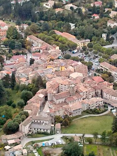
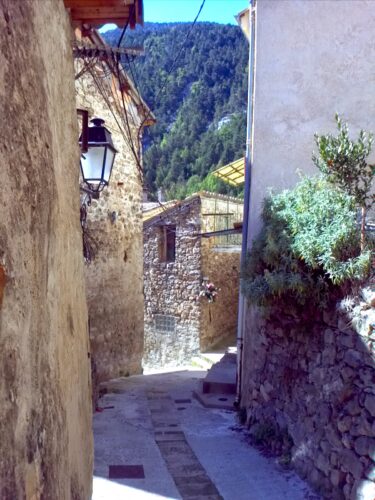
Annot is also an old town inside ‘walls’ – actually walls of churches and houses rather than a separately built enclosure. There are numerous winding alleyways between the tall houses opening out into squares here and there; and there are two old lavoirs. The 11th century church is in one of these squares but always seems to be closed. Annot seems much more lived in than Entrevaux while the latter seems more like a museum.
-
- Annot from le Baou
-
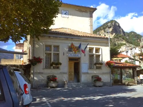
- La Mairie Annot
-

- Café du Commerce Place de la Mairie Annot
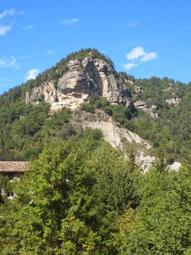
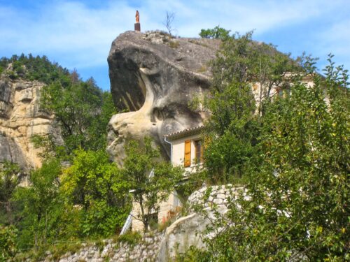
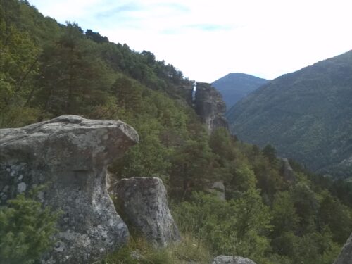
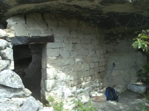
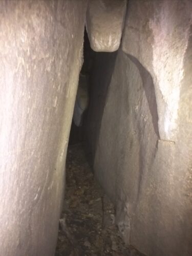
Annot is immediately below a an impressive escarpment of limestone rock containing numerous caves. Some caves quite close to the town have houses built into them, one high on the hillside was used to hide people during WW2 and there are troglodytic ones include the Chambre du Roi. The Grès d’Annot is a very popular circular walk over this outcrop, past the caves and the numerous bulging mushroom shaped rocks.
Market, bars, shops: market day is on Tuesdays in the big square by the Mairie outside the walled town. The Bar du Commerce in this square was our favourite for coffees although we sometimes went to the bar of Hotel Beauséjour. Boulangerie, MiniMarket, pharmacy etc are to be found not far from the main square.
Accommodation: We stayed six nights with Julienne and Jacques Ballester at Le Baou, a chambre d’hotes at la Ribère about 500m up the valley from the main square of Annot with the river Vaïre passing at the bottom of the garden. We had booked as normal and were surprised to find that the ‘room’ was in fact more like a studio – with a fully equipped kitchen, a dining table and a sofa as well as bedroom and bathroom. In addition there’s a big table outside under a canopy. Julienne brought the first breakfast which was the most varied and copious one – pancakes, cheese, ham, yogurt, melon, apple purée, spice cake , bread, jam and hard boiled eggs. Although we kept some of the food for our picnic, we didn’t make much of an impression on it. Later in the day, Julienne and Jacques suggested that we could stay for a reduced rent but without the breakfast. We were pleased to accept the offer. Jacques kindly collected 2 baguettes for us each morning. We then discovered that Jacques is a very keen hiker and was able to help us to plan our walks and even drove us to the start of some of them.
List of walks around Annot
The GTPA (Grande Traversée des PréAlpes) arrives from Entrevaux by the Gorge de Galanges. It seems to have two branches near Annot, one running at a high level on the west side of the Vaire valley past Annot and down to le Fugeret and Méailles. Another branch links Méailles back to Annot via the Voie Romain. The Office de Tourisme in Annot offers a useful list of walks and we used it to find our first couple of walks, then Jacques took over as our walking mentor, suggesting a new and interesting route for each day throughout our stay and taking us in his car to the starting point for most of them. Jacques is the sort of host we like, really concerned to help his guests enjoy a (very) active holiday!
- le Gres d’Annot 8 km, 900m denivelé (both ways):
-
- Gres d’ Annot path
-
- Jardin du roi
-

- On the Gres d’Annot path
-
- Portette
-
- Interesting rock shapes
-
- Picnic stop at the ‘Abris’.
a circular walk from Annot through chestnut and oak woods, houses built into caves, WW2 hideout under rock where we had picnic, les Portettes, Chambre du Roi, Jardin du Roi, view down over Vaïre valley. (George doubled back and repeated the walk in reverse to look for our Didier Richard 1:50k walking map, which we had left at a picnic spot). He didn’t find it so we immediately bought the relevant IGN TOP25 (1:25k) map – an indispensible companion.
- le Baou de Parou 5.6 km, 400m denivelé:
-
- Le Baou
-
- Farm above Annot
-

- Chemin Romain
-
- Picnic spot on Le Baou
-
- Picnic stop at the ‘Abris’.
-

- The Grès from below
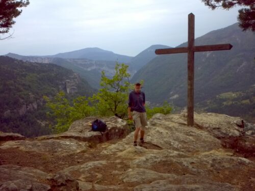
a loop up and round a giant limestone outcrop called le Baou, through chestnut and pine woods. Viewpoint with cross where we had picnic. Descends via gorge Beïte.
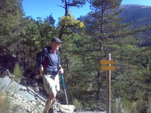
- Clot Roubaud 9.7 km, 550m denivelé:
-
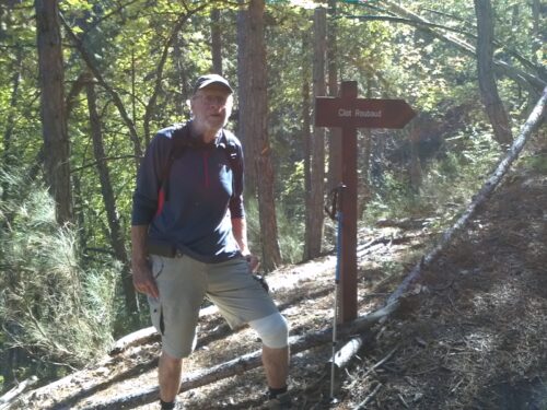
- Walk to Clot Roubaud
-
- Walk to Clot Roubaud, disused cottage
a circular route starting above the old stone bridge across the Vaïre; steep continuous climb onto GTPA where we entered the beach woods that extended all the way along the route down beside the gorge de Galanges and then the Vaïre.
- Chabrières – Argenton – Annot 16 km, 440m denivelé:
-

- Bridge at Chabrières
-
- On the path to Argenton
started at Chabrières well above Braux on a bumpy road where Jacques dropped us. A very attractive path up to Argenton and down past la Béouge passes through small scale farmland with stone buildings and a few animals. It joins the Voie Romain (on GTPA) a wide path paved by the Romans that goes all the way down to Annot.
- Méailles to le Fugeret 7.7 km, 180m denivelé: described below under Meailles.
- le Fugeret to Annot 15 km, 620m denivelé: described below under le Fugeret.
Other small villages/hamlets
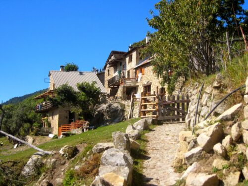
Le Fugeret
-
- Le Fugeret
-
- Le Fugeret
-
- Le Fugeret
-
- Le Fugeret
-
- Le Fugeret
-
- Le Fugeret
Le Fugeret (at 835m) is upstream from Annot on the river Vaïre and also on the train line two stops beyond Annot. It is an optional stop – if you want to get off, you have to warn the ‘chef du train’. To get on, as we did at Fugeret you have to stand on the platform and signal to the driver – wave your arms.
The small road from Annot runs along the edge of the old village whose houses cluster in a tight group above. Narrow meandering alleyways pass between the old stone houses, sometimes ducking under little tunnels and archways as they wind up or down the hillside.
There is a bar, a Gite d’Étape and drinking fountain beside the road. Above Le Fugeret are extensive chestnut farms .
Walk from Le Fugeret to Annot:
-
- Le Fugeret to Annot via Roncharel
-
- Near Roncharel
-
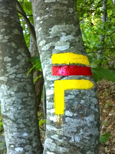
- Balise
this walk starts from the far side of the bridge over the Vaïre at the upstream end of the village. It passes a cottage with a beautiful garden that covers the path and then climbs steadily up until a source where it is supposed to join a wide track running level at about 1100 (which required 3G and GPS and a scramble to locate). At the Auberge de Roncharel (a Gite d’Étape) we joined the GTPA which heads towards Entrevaux and took a turn down to Annot.
Méailles
-
- Méailles
-
- Méailles
-
- Méailles
Méailles upstream from le Fugeret is a very pretty old stone village perched on a hilltop above the river Vaïre and the railway station. There is a bar, pizza place, but absolutely no shops. From the square at the top of the town little staircases lead down between the houses and into a small square by the old church which has a tower topped by pyramidal roof.
Walk from Méailles to le Fugeret (yellow line):
-

- On the road to Méailles
-
- Méailles to Le Fugeret walk
-
- Slippery slope!
-
- This is a path!
-

- Méailles to Le Fugeret walk
-

- Méailles to Le Fugeret walk
-
- Near Roncharel
-
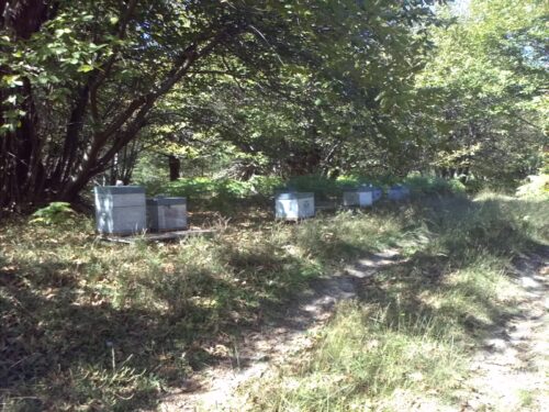
- Beehives
-
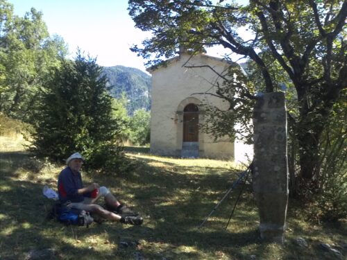
- Picnic at Chapelle de la Salette
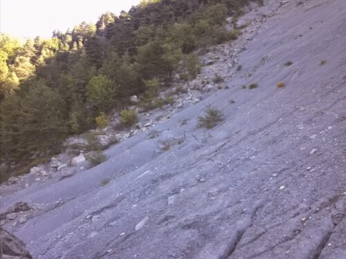
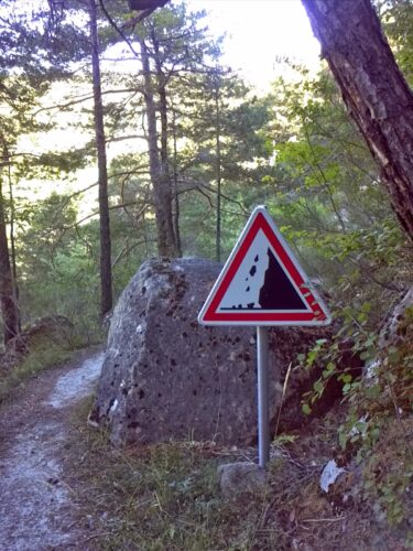
a very attractive (GTPA) path rises from village (signed to Argenton) through farmland and pine, chestnut woods. Encountered a landslide (tricky for us). At 1150m turned back down path signed to Gite d’Etape at le Fugeret. Chestnut woods open out into big orchard of chestnut trees. Good picnic place by Chapelle la Salette above le Fugeret.
Argenton
-
- Argenton
-
- Argenton
-
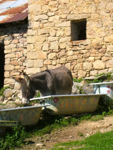
- Argenton donkey
We came upon the tiny hamlet of Argenton (1300m) on one of our walks. We had been following a lovely path on the side of a hill past small enclosed plots of land – one housing a heiffer. The path went up towards a small group of stone buildings and emerged through a gate. Someone greeted us from a window of a building labelled “Gite de Marmottes” and just beyond we came upon a little buvette. We stopped for cold drinks and a chat with the very welcoming owner who told us how to find the Roman remains shown on our map. In the summer people stay in the gite and meals are provided. Between Argenton and la Béouge there are are several small farms.
St André les Alpes
The train trip from Entrevaux to St André les Alpes is scheduled to take one hour. The line heads up the valley above Méailles to a tiny halt at la Peyresq where it enters a very long tunnel under the mountain, emerging in the Verdon river valley, soon stopping at Thorame-Haute Gare. Thorame-Haute (900m) looks like an interesting place for future hikes. The train line follows the Verdon through Barreme and into St André des Alpes.
St André les Alpes is at the head of Lake Castellane – a reservoir fed by River Verdon which then does on to the famous Gorges de Verdon. There are some fairly old buildings in the a small town centre and the usual shops and bars, but it lacks the charm of Enrevaux and Annot so we were content to limit our visit to a single afternoon. A path leads out of town past tennis courts and campsite with pines and then on to the river bank and then over a bridge and on to the lakeside. This is a wide valley with green mountains but they don’t look so exciting as those around Entrevaux.
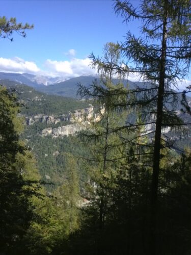
Seen from walks
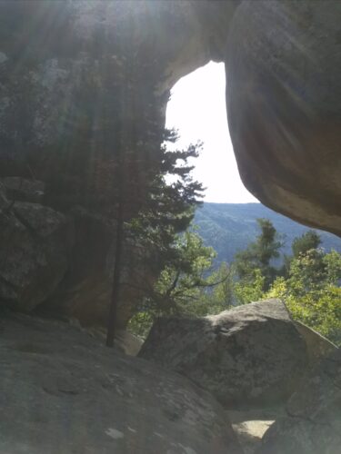
Amazing mushroom shaped rocks, caves, troglodytes, WW2 hide out, Chambre du Roi, and so forth on le Gres d’Annot:
-

- Abris on the Grès path
-

- Picnic on the Grès path
-
- Gres path
-
- Chambre du Roi
-
- Gres path
-
- Gres path
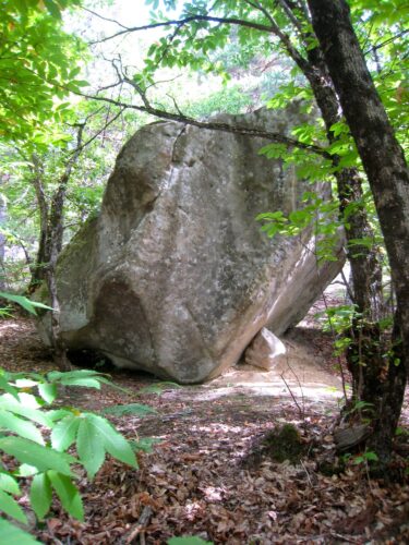
Voie Romain, paved with big slabs of rock:
Voie Romain
The very attractive paths in partially cultivated areas e.g. near Argenton:
On the Argenton – Annot path
Roman remains and Oratoires – at Argenton and Chapelle la Salette.
Farming
Chestnut grove near Méailles
Chestnut farming: terraced orchard of chestnuts above le Fugeret of ancient chestnut trees laden with chestnuts. We wondered how chestnuts are harvested and googled “machine a récolter les châtaignes” to find several videos on YouTube that illustrate some amazing machines with rotary whips to get the chestnuts into the machine and a giant vacuum thing to lift out the actual marrons.
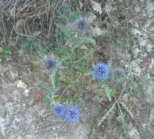
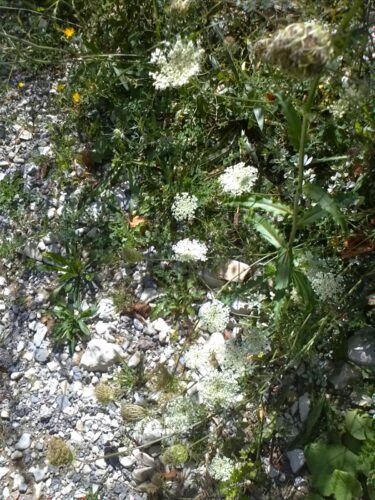
Flowers and mushrooms
We missed the glorious show of flowers to be seen earlier in the year and at higher altitudes. Here are photos of a few that we did spot
-
- Thistle
-
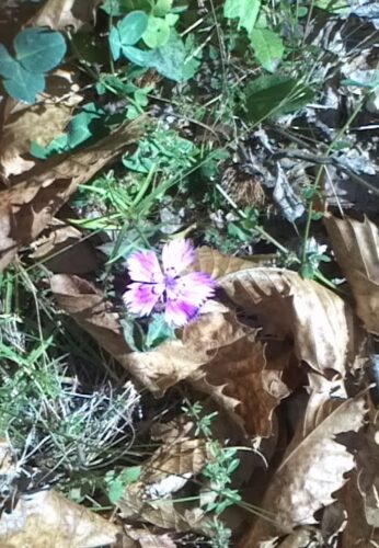
- Oeillet
-
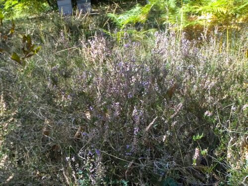
- Heather
-
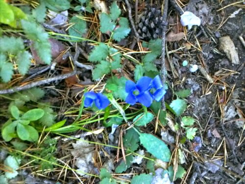
- Blue flower
-
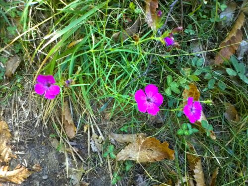
- Oeillets des Alpes
-
- Walk to Clot Roubaud
But we learned about two new bushes and an interesting mushroom.
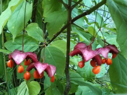
Fusain: on our first descent of the Voie Romaine into Annot we came upon several bushes with brightly coloured flowers which at first we took to be fuchsias. But on closer inspection, the flowers although quite complex in structure were quite different. A ring of deep pinky-purple petals surrounds a group of hanging orange balls. With some help from friends we found its name: Fusain (which also means drawing charcoal in France). We met Fusain again when coming down the valley on the other side of Annot.
-
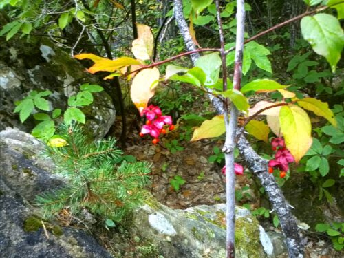
- Fusain flowers
Troène: being September we had seen many bushes with berries, for example the low-lying and prickly juniper shrubs and a few blackthorns with sloe berries. But we kept seeing another one with small black berries – more scattered and a little larger than elderberries and more like a bush than a tree. With further help from friends we found it was called Troène commun: the berries are poisonous and it’s a relative of Privet.

Troène
Coulemelle: we learned the name of this mushroom when we came upon some women who had harvested bags of them. We later saw them now and again on our walks. They have a big ball at the top of a narrow stem. Some of them are brown and white and some mostly a very light brown. They all have little flakes of skin on the ball.

Coulemelle champignon