Walking in the Calanques of Marseille, March 2014
Introduction
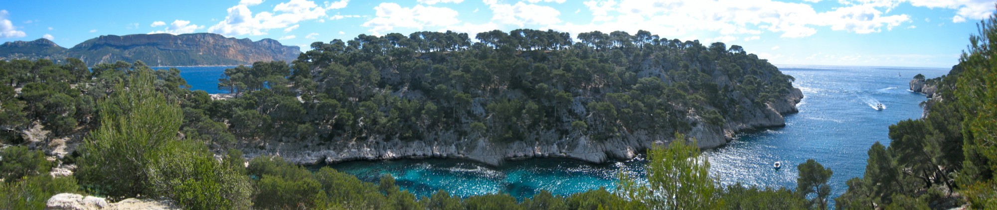
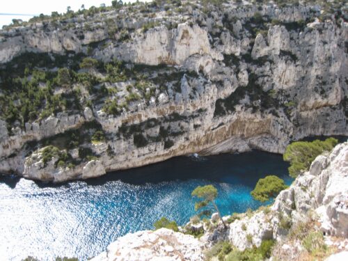
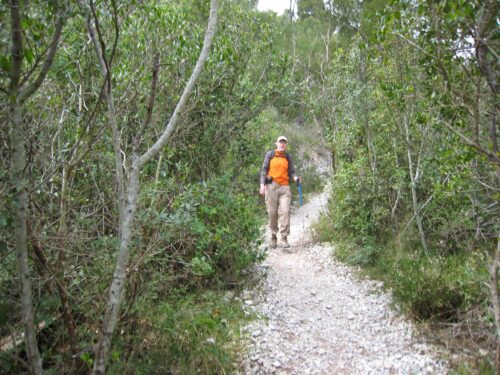
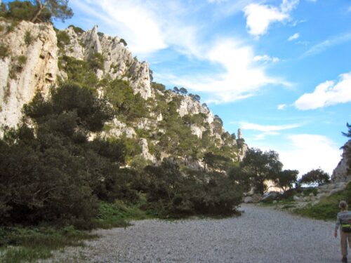
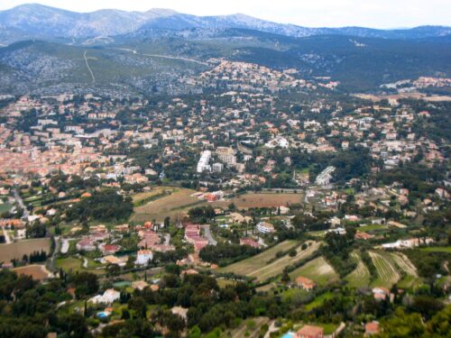
Calanque de Port Pin
We like to plan a walking holiday in the spring so as to break away from the gloom of winter and to get out on the footpaths once more. We have wanted to see Marseille ever since seeing the film Marius et Jeannette and then hearing about it from people who live there. During our investigations, we read Philip Oltermann’s Guardian article A walk on the Cote d’Azur’s wild side about a stay in Cassis and walks to the Calenques. So we decided to stay in Cassis, to walk round the Calenques on fine days and to go into Marseille when it rained.
We booked Studio Cassis for a week. This studio is adjacent to the house of the very friendly owner Josette Bert. It is a short walk to the centre for shops and shore. But to book you need to phone the Mme Bert as the internet booking seems not to work.
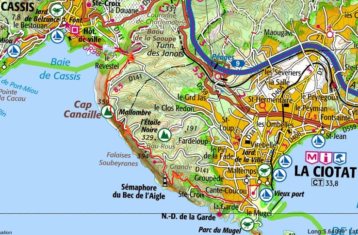
We bought the IGN walking map 3245 ET. Aubagne La Ciotat. 1:25000 which covered the two walks we planned on the Calenques and a wider area for the other two walks we did.
Saturday 22nd March. London to Cassis
Journey out and arrival in Studio Cassis
The Eurostar left St Pancras at 8:05 am allowing us plenty of time to cross Paris from Gare du Nord to Gare de Lyon for the 12:35 TGV to Marseille St Charles where we arrived at 4:05 pm with only one stop at Aix en Provence and a fleeting view of Pont du Gard just before.
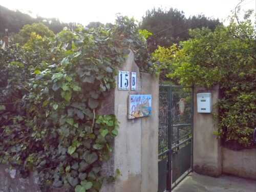
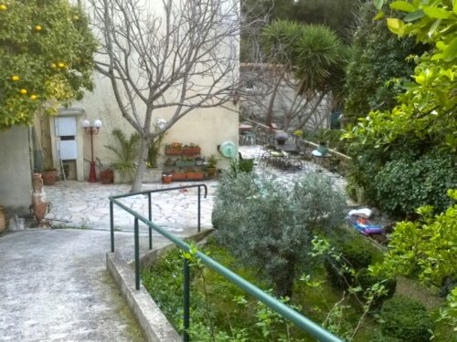
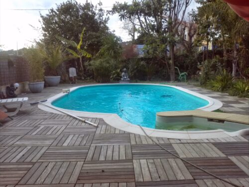
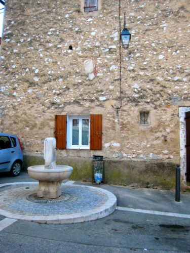
The little coastal train fromMarseille St Charles to Cassis arrived at 5pm and we walked the 4 km to the centre through the rain, past the Cassis vineyards and eventually reached Studio Cassis at 15b Avenue Augustin Isnard. Mme Josette Bert welcomed us, took us past the grapefruit tree, through the garden in front of her house and through a little gate to the studio and left us to settle in. In spite of a very advanced age, she keeps her garden in a beautiful state. The studio has a view over this garden which sprouts multi-coloured solar-powered lights at night time. But for warmer weather there is a pool and even in spring time we were able to use various shelters containing eastern ornamentation with exotic plants nearby.
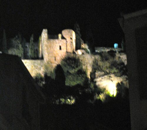
We did a quick shop at Casino and a boulangerie and wandered down to the shore and were surprised by the very big waves. By now it was dark and a floodlit castle appeared on (what we thought was) the cliff top above the town. A few days later we did walk to the cliff top and it was far above this castle, which was just a hotel.
We walked round the bay past numerous moored yachts and stopped at a tiny pizza place with a charcoal oven: La Fringale (great hunger) run by Marcel who cooks, entertains and generally manages on his own. The pizzas were giant so we took at least half home in a box provided by Marcel. By the time we left a good dozen people had crowded into the tiny room.
-
- Villa Bella Vista
-
- Villa Bella Vista
-
- Villa Bella Vista pool
-
- Cassis Chateau
here is an album with all the photos
Sunday 23rd March. First walk to see the Calenques
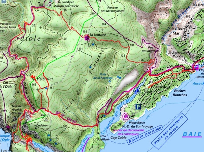
via Port Miou and Port Pin and along coast path above Calenque d’En Vau (the red line on the map)
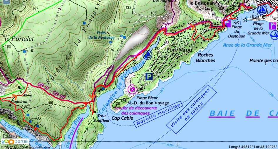 GPS track on Visorando Distance : 12.6 km, Dénivelé : 462m, Point haut : 147m
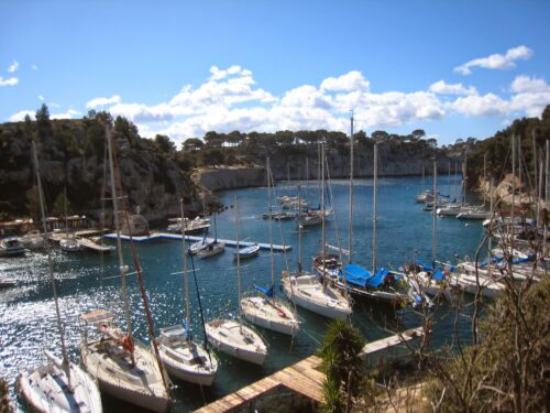
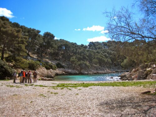
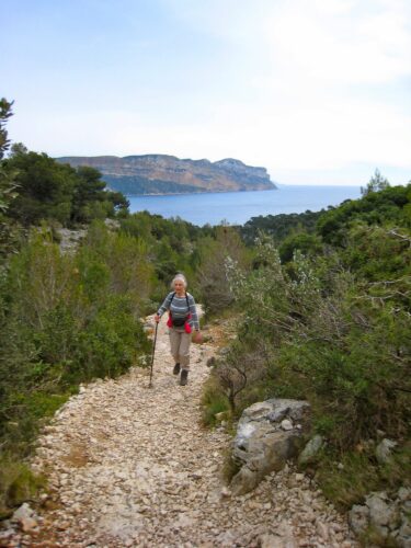
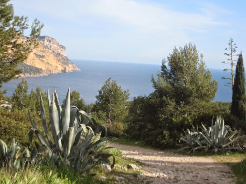
A very windy day with sunshine most of the time and a few tiny drops of rain. The wind was from the north so we concluded it was the Mistral and others confirmed that. We walked out of Cassis, round the bay past Plage du Bestouan and then followed GR signs to Port Miou bay (about half an hour). The calenque of Port Miou is very long and narrow and being accessible by road is full of sailing boats. The path follows the north-west side of this Calenque, gradually climbing the cliff. Eventually the path goes through an area with pine trees and then descends to the beach of the second Calenque (Port Pin).
-
- Port Miou
-
- Calanque de Port Pin
-
- Picnic stop
Even on a Sunday, the number of walkers had diminished by this stage and this little beach was peaceful with a view down the calenque towards the sea. People drew our attention to the Souffleur: a tiny hole in the rock through which a strong breeze blew from far below.
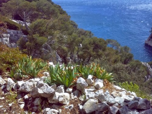
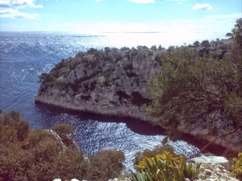
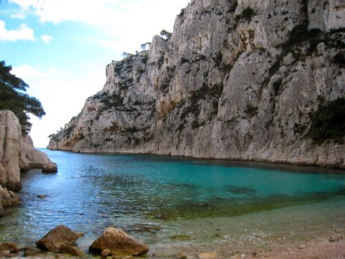
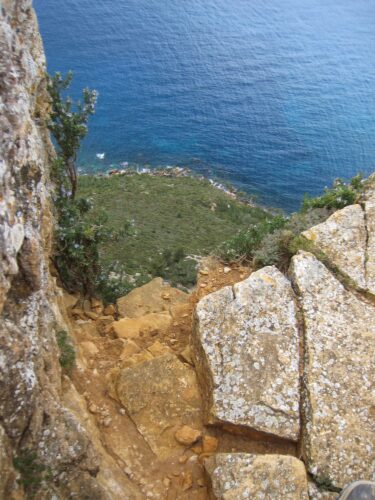
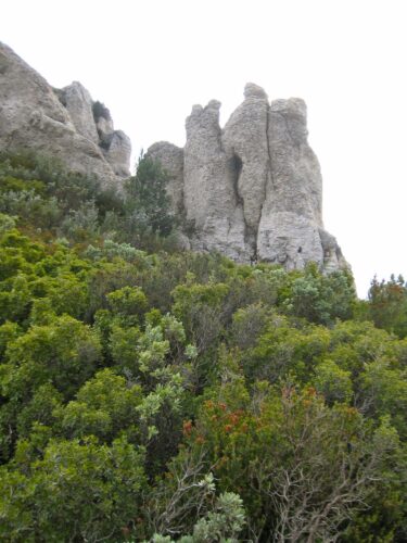
Rather than following the GR we took the path round the promontory between this and the third calenque. This route is clearly marked with blue paint and at first climbs up and follows the north-west edge of Calenque Port Pin on a rough, steep path on limestone rocks, surrounded by many small pines and those bushes that look like rosemary (but don’t have the aroma). Eventually the path goes round the point and follows the edge of the third calenque – d’En Vau.
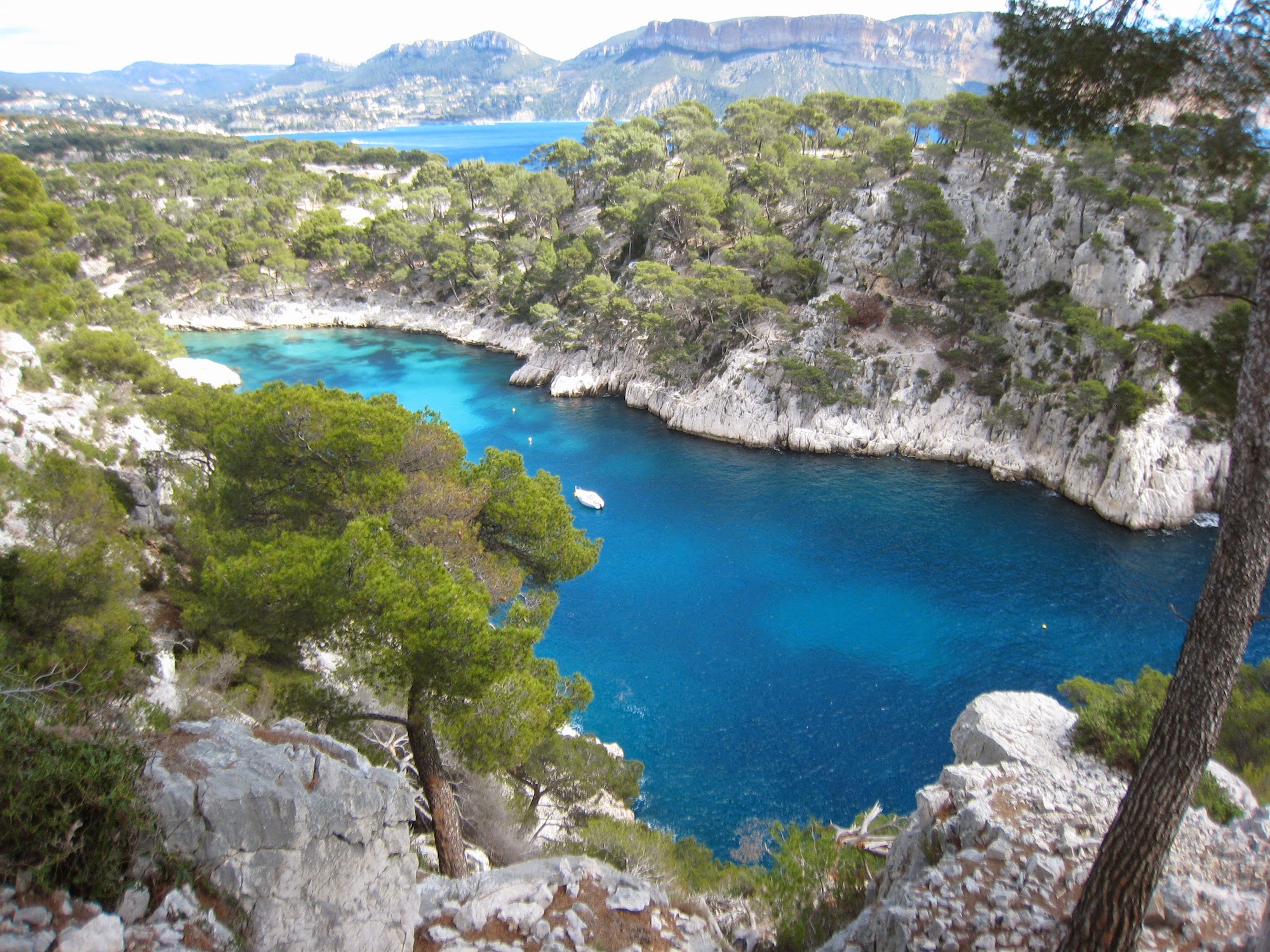
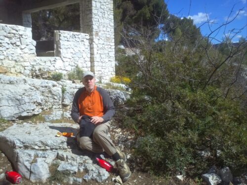
About half way along the calenque d’En Vau, we stopped for a picnic lunch outside a ruin that we hoped had been shelter for a goatherd, but we feared may have been a 2nd home. But either way, we enjoyed the views over the Calenque d’En Vau far below. Then as we walked on we found a distant view of the little beach far below (which we left for a future visit). This beach has tall white cliffs on the far side and many spiky/knobbly pinnacles in front of it.The path then swings round another 90 degrees clockwise and joins the GR providing a more direct route downhill to Port Pin from whence we retraced our steps via Port Miou to Cassis.
-
- Calanque d’ en Vau
-
- Calanque d’ en Vau
-
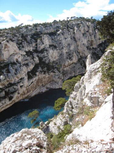
- Calanque d’ en Vau
-
- Calanque d’ en Vau
Back at Studio Cassis, we sat in the beautiful garden by the pool enjoying a relaxing drink. But by 5pm it was getting cool, so we went inside and prepared a simple supper from the remaining two half pizzas from la Fringale together with some salad, followed by patisserie.
Tried to watch film on TV but (we kid ourselves) the reception wasn’t good enough for us to understand the French. But the news was dismal, FN doing well in first round of local elections.
Looking out of the window we were astonished to see scores of coloured lights all round the garden. Lots of little solar powered things in the flower beds.
Monday 24th March. In Marseille
Sights, not museums. We chose Monday when all museums are closed so we would be sure to concentrate on the streets.
Left studio hoping to catch shuttle bus to station, but couldn’t see it on timetable at nearby stop so did very rapid march up hill, past the Cassis vineyards to the station and the bus passed us both just in time for 10 am train.
Marseille station: on exit one is at the top of a grand flight of steps on a very wide platform, in front of a classical station building. All down the steps are art nouveau lamps and railings.
We set off southbound towards Canebière – a long boulevard and the main street with 6 storey 18 century buildings with decorated balconies. This led us straight down to the end of the old port where we found us under a ‘pavilion’ designed by Norman Foster (a mirror above our heads).
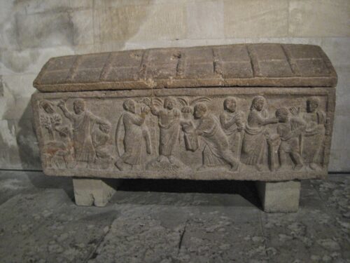
We walked along the south side of the port (Rive Neuve) until we came to the Basilique St Victor. This is a tall, 11 century fortified building with high small windows and round arches. We admired a stone sarcophagus with carved figures and an altar with carved animals. According to a video we watched there is a lot more fine carving in the crypt.
-
- View of old port form Notre Dame de la Garde
-
- Carved tomb in Basilique
-
- Notre Dame de la Garde from the Vieux Port
-
- Marseille Bas Port
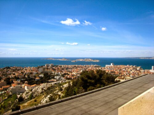
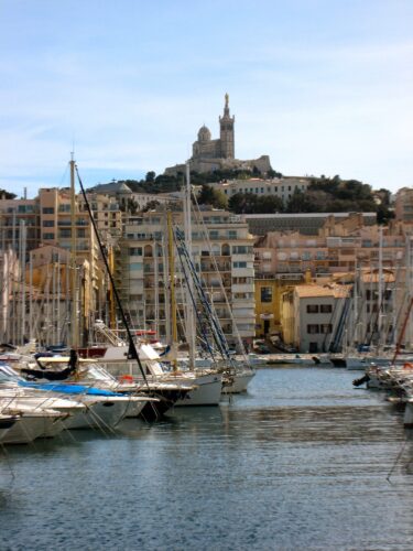
We climbed the hill to N-D de la Garde (said to be a good view point for an introduction to Marseille). This is a 19th century candy stripe romano-byzantine style building eventually reached at the top of a long flight of steps. We were rewarded by magnificent wide panoramas and views of the fortresses around the old port, the sea and the isles of Frioule and Chateau d’If in behind and on the other side the city extending all round, backed by the hills.
We found a better route down via Blvd Aune mostly pedestrianised. At the bottom we went into the Quartier des Arsenaux and sat on the sunny side of a big square eating paninis.
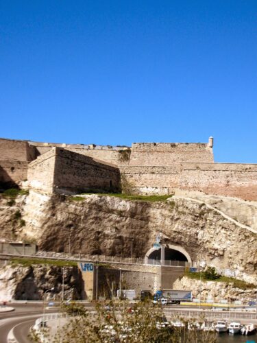
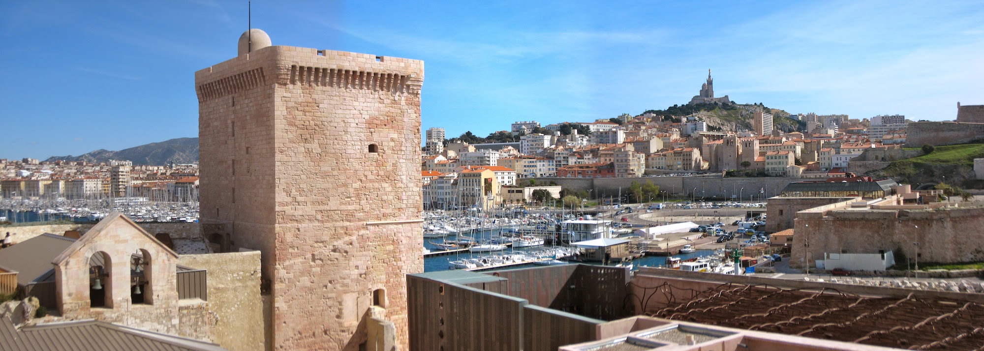
Then took the ‘Ferry Boat’ across the water to the Old port, arriving outside the Hotel de Ville – a baroque building with sculptures by Puget (more later). We walked along the dockside as far as Fort St Jean which we entered. This fort and the other two commissioned by Louis 14th (mid 17th century) : St Nicholas (opposite) and St Laurent are all build from large rugged pink stones
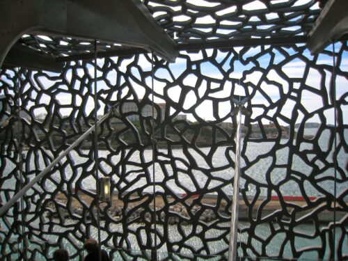
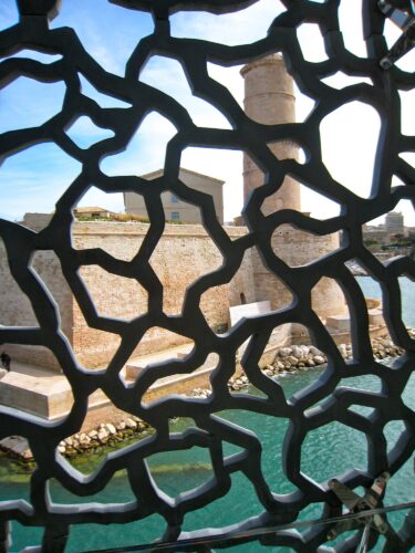
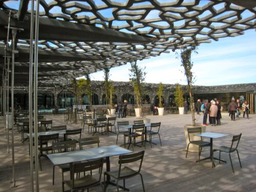
We found walkways all round the forts going in and out of courtyards, with comfortable benches and occasional gardens and linked by a narrow bridge over a small dock to the Mucem (museum of civilization of Europe and the Mediterranean). And by another bridge to the Le Panier district. We guess this was all built in 2013 when Marseille was European Capital of Culture.
The Mucem is housed in a big glass building with a strange latticework outer skin made of bent strips of concrete reinforced by fibre. A walkway runs round the building inside the skin and appears to be supported by dark grey concrete tree trunk like structures. After circulating the building a few times, we arrived at ‘ground level’ outside the building.
View from Fort St Jean
-
- MuCEM
-
- MuCEM
-
- MuCEM
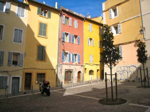
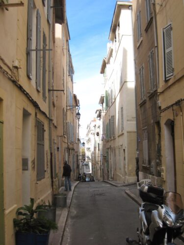
We made our way to le Panier (with difficulty) via Musee Regards de Province and Cathedral de la Major (another 19th century candy-stripe church). Quartier le Panier has been occupied since the time of the Greek colony Massalia (600 BC). It is characterised by narrow streets (some more like alleyways) with tall, colour washed houses.
On the far side of le Panier is the Jardin de Vestiges where the archaeological remains of the greek port are kept. From outside the fence, this looked pretty much like stones and grass.
-
- Le Panier
-
- Le Panier
Walked back up Canebière past the Bourse and into Market of Capucins (mainly fish and fruit) – we bought 500 gm gigantic strawberries for 1€. The train station was swarming with young soldiers and police all carrying guns – seemingly concentrated by the platform where we took the train back to Cassis.
Good meal in le Chaudron (in a little alleyway) fish soup, fish / pasta, pana cotta. Good Cassis wine (white) Dom Paternel.
Tuesday 25th March. Walk to Calenque d’En Vau (and back)
Walk to the third Calenque – involving a steep path and avoidance strategies
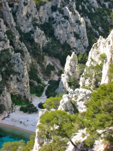
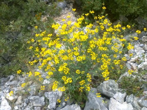
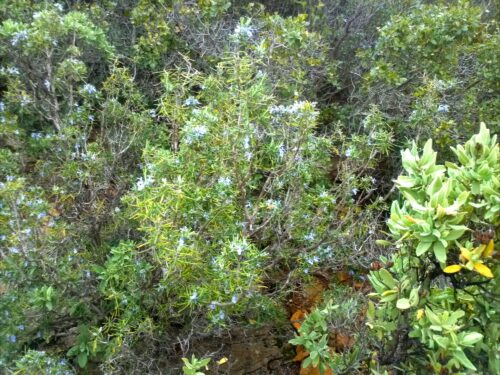
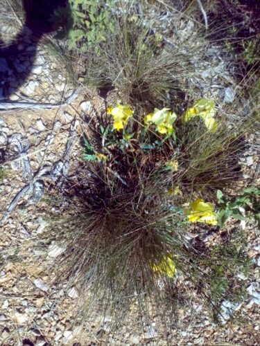
Started at 10.30 am taking the same route as on Sunday as far as Calenque Port Pin, then followed the GR95 – a very attractive path that winds up the hill between small pines, euphorbia, yellow flowers and real rosemary in bloom. But we then tried to continue on the GR as it descends steeply towards Calenque d’En Vau. The path was unstable and we withdrew as did several others. We searched for an alternative way by going north away from the coast on a track (yellow on the IGN map) and then turning left on a track by helicopter pad. This seemed a really well-maintained path with walls at bends, but it suddenly disappeared, so we stopped for lunch under some pines.
-
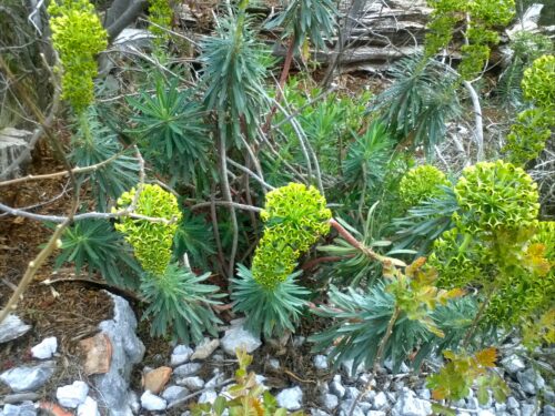
- Euphorbia
-
- The path to Calanque d’en Vau
We then tried another less well defined path that followed a stream bed parallel to the yellow path. It eventually joined the GR at the bottom of the difficult passage. After 10 mins or so of scrambling we reached a level widish path where we turned left, heading towards the cove. We were surrounded by tall, knobbly peaks up which groups of young people were climbing.
-
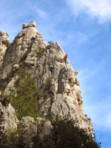
- Climber above Calanque d’en Vau
-
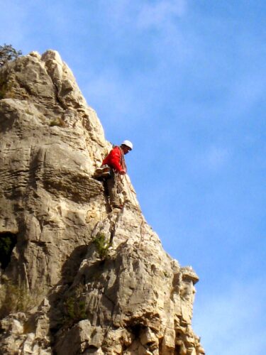
- Climber above Calanque d’en Vau
-
- Calanque d’en Vau
-
- Calanque d’en Vau
The Calenque d’En Vau is very beautiful and secluded. After a peaceful rest on the beach and George had tested the water (by paddling) we decided on a long alternative route back avoiding the steep path.
The first part – a walk up the Vallon d’En Vau (followed here by the GR) was a very attractive path in a hollow lined with bushes and surrounded by white limestone peaks. Then close to le Portalet, the GR turns left to Col de l’Oule (on its way to Marseille). We continued up the hill to about 200m and then turned right past Maison Forrestiere. This track (yellow on the IGN map) goes past la Fontasse (is it private or a youth hostel?).
-
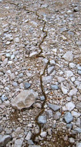
- Catapillar ‘snake’
-
- Leaving Calanque d’en Vau
-
- Leaving Calanque d’en Vau
Finally the track follows many wide lacets to Port Miou with views down the valley behind it. A long walk! But the return part was very easy.
Stayed in, ‘cooked’ a tin of Couscous Royale and followed up with patisserie for desert.
Wednesday 26th March. Walk to La Ciotat
We hadn’t planned this walk, but it was one of the best…
Started the day with an attempt to visit Marseille, but missed the train! So eventually after exploring the Cassis Street market and stoking up on fruit and bread we set off rather later than usual.
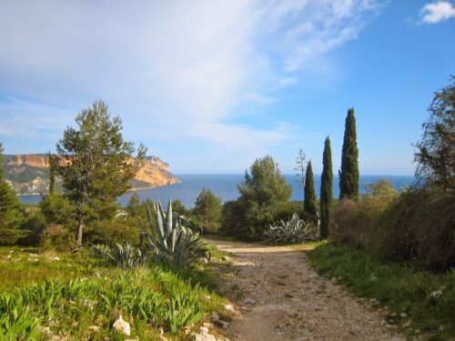
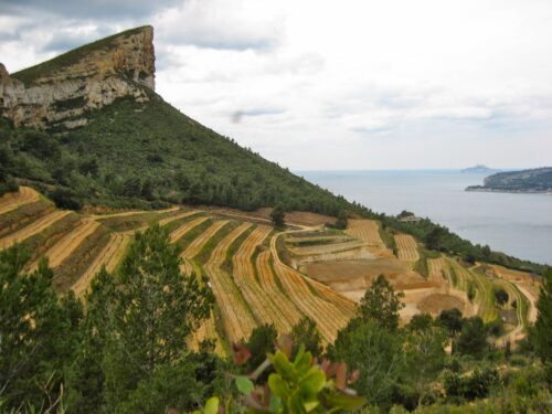
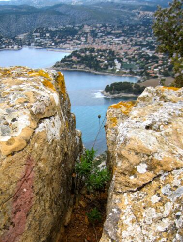
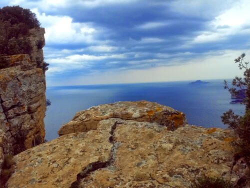
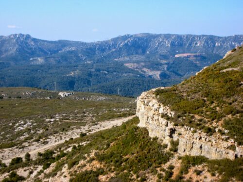
Mme Bert had suggested a walk up the cliff above the castle for magnificent views of the calenques. As advised, we left Cassis via Rue des Arènes and then turned into Av Revestel (a virtually traffic free road signed as a GR). After lots of climbing and far above the ‘castle’ (actually a hotel), we joined the Route des Crêtes for two loops and then found a well-marked track io the right-hand side of the road. This route which we will call the ‘yellow path’ is signed with yellow marks all the way to la Ciotat and follows the top of the cliffs.
-
- Rosemary in flower
-
- Vineyard of le Revestel
-

- On the Crȇtes path
-

- Cassis from the Crȇtes path
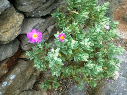
This first climb was 306m and took just over an hour and was quite hard even on good surfaces. On the way up we had views back over the terraced vineyards. The ‘yellow’ path at first follows a track through verdant undergrowth including masses of rosemary in flower and numerous light-green-leaved Cistus bushes. This path (to our surprise) took us right to the edge of the cliff, where we stopped for a picnic with views back to the calenques and a big drop below us to the narrow seashore – we noted some climbers’ rings in the rock beside us.
-
- Cassis from Crȇtes pat path
-
- Picnic spot Crȇtes path
-
- Picnic spot Crȇtes path
-
- Picnic spot Crȇtes path
This path follows as close as possible to the edge of the cliff. But at one point we inadvertently followed some blue signs and saw a big hole (which we didn’t fall into). Now and again the path drops down and passes by the end of the loops in the road. At one of these there was a choice of a lower path to la Ciotat but we decided to continue on the cliff tops. At another point Jean tripped on a tree root and fell flat on her front, but after recovering her breath, there was no lasting damage.
Then we took two loops on the road for a change, but on arrival at the “Semaphore” a light house, we rejoined the footpath for the descent into La Ciotat which passed through lovely verdant landscape and here the Cistus bushes had a few purple flowers.
-

- Passing the Sémaphore du Bec de l’Aigle
-
- Purple Cistus
It took quite a while to get to the centre of La Ciotat where we stopped for refreshment and were told that the 6pm bus doesn’t run on Wednesdays as it’s a school bus. Actually it was worse than that! the bus station refused to give us information as the bus in question wasn’t one of theirs! Tourist office tried to explain…Took a taxi back to Cassis (€25) ..
Another meal at Marcel’s pizza place. We shared a big mixed salad (egg, tuna, …) and followed up with a shared pizza and then Crème brûlée between us.
Thursday 27th March. Day in Marseille
Palais Longchamps and Vielle Charitée
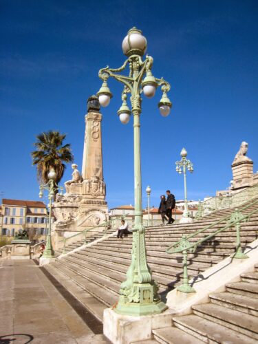
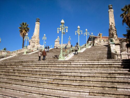
We started well by catching the 9.35 navette to Cassis station and getting the 10:05 train to Marseille. Lots of firemen on the train and even more demonstrating at the top of the steps outside the station. St Charles station must once have been a key stage on sea voyages to Africa and beyond. The station is approached by a grand staircase bordered by statues inspired by all the distant locations to which people sailed from Marseille’s port. There is another level approach for those that need ir.
-
- Marseille St Charles station
-
- Marseille St Charles station
-
- Boulevard Longchamp
-
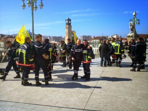
- Sapeur Pompiers demo
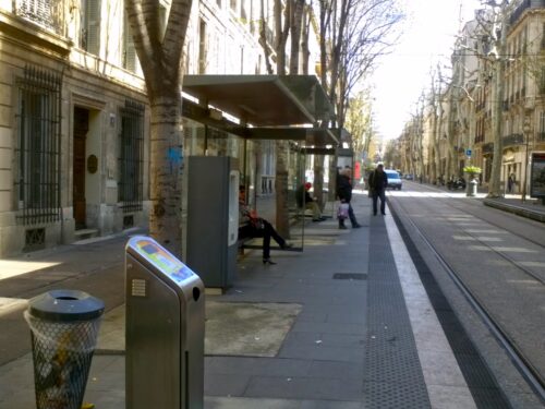
We headed for Musée Grobet Labadie which is next door to Palais Longchamps. Boulevard Longchamps is impressive in that all through motor traffic has been eliminated, leaving a two-way tramway up the middle. On either side of the tramway is a wide strip with trees, motor cycle parking and island stops for the trams. Next comes the cycle lanes actually rather narrow, but few cyclists to be seen. Then next to the buildings is a wide footway area. The occasional motor comes in from a side street but doesn’t seem to stay long. At the entry are rising bollards across the side areas and a trench under the tramlines.
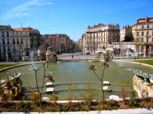
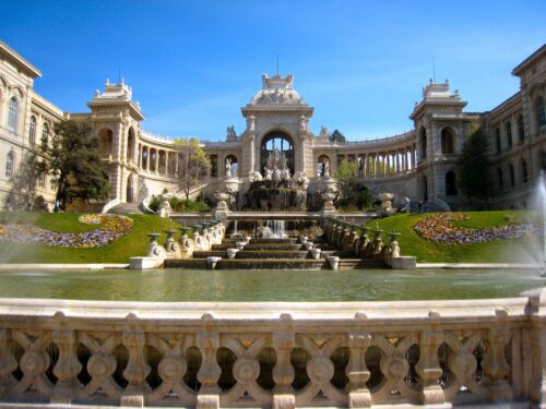
It turned out that Musée Grobet Labadie will not open until July so we decided to make an impromptu visit to Palais Longchamps which has an impressive array of fountains and sculpture on the facade because it was designed as a Chateau d’Eau (watertower). In 19th century King Louis Philippe commissioned an aqueduct to bring water 50 km from the Durance at Pertuis to Marseille. It was Napoleon 3 who commissioned the magnificent palace with a staircase in front of it. At the top of the stairs is a garden and at the back of that is the canal containing the water supply which still provides 2/3 water needed in Marseille.
-

- Musée Grobet-Labadie
-
- Palais de Longchamp
-
- Palais de Longchamp
-
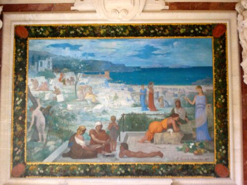
- Puvis de Chavannes mural
One wing of the Palais Longchamps contains the Musée de Beaux Arts. The entrance contains two murals by Puvis de Chavannes illustrating the history of Marseille. Some of the most interesting paintings were 19th century illustrations of Marseille and the surrounding countryside. Pierre Puget the Marseille- born 17th century sculptor is well represented in this gallery by both paintings and sculpture.
The wind had dropped and it seemed very peaceful eating sandwiches in the palace gardens before catching a tram down to the le Panier area to visit Vielle Charitée. The town council decided to build a place to shelter the poor – it was designed by Puget but completed much later on. A chapel with baroque oval dome sits at the centre of a large courtyard surrounded by stone arcaded wings.
-

- Vielle Charité
-

- Vielle Charité
-

- Vielle Charité
These wings contain a big collection of mediterranean archeological items. We had time only to visit the Egyptian rooms. Then we walked through an exhibition “Visages, Picasso, Matisse, Warhol…” which presented different aspects of portraiture, e.g. under the Nazis and after WW2, painters (Giacommetti and several German painters) showed shadows of real people; then there were dreams (de Chirico and Marinetti); in the sixties, people were posterised (Warhol and other pop artists); another theme linking Picasso and Bonnard was mirrors. The final room (in the chapel) said it was about the ‘function of thought’.
No bus to meet the train back to Cassis, but a kind lady gave us a lift. We had our meal in the studio.
Friday 28th March. To Pagnol Country
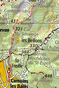
Aubagne, la Treille and Taoumé
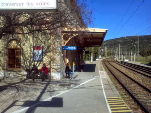
We arrived at Cassis station only to find that the train to Aubagne was cancelled so we sent back to the town and took the 68 bus which after a delay, delivered us to the bus station (next to the train station) in Aubagne.
-
- Cassis Gare
-
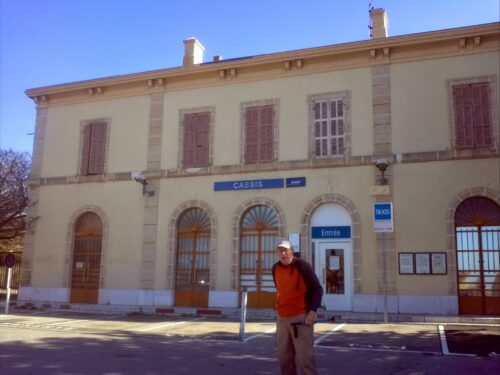
- Cassis Gare
We walked into the centre of Aubange and found Marcel Pagnol’s birthplace in Cours Barthélemy – a tall town house with balconies. But he lived there only until the family moved to Marseille when he was about 3. In the square nearby is a metal panorama showing the position of the peak Garlaban and a quote from Pagnol’s La gloire de mon père. “Je suis né dans la ville d’Aubagne, sous le Garlaban couronné de chèvres, au temps des derniers chevriers.”
-
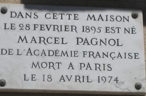
- Marcel Pagnol
-
- Pagnol birthplace
-
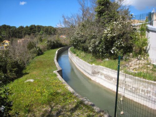
- Marseille water channel passes through La Treille
Local buses are free (and bear signs Liberté, Egalité, Gratuité). One of these took us out of the town and up the hill to la Treille, dropping us by the cemetary where Pagnol was buried.
We had with us the description of a walk The Marcel Pagnol Circuit from the Visorando website, which describes a walk from la Treille up to Taoume past la Bastide Neuve where Pagnol stayed in the summer holidays from the age of about nine and a half. The area above this house is the main background for Pagnol’s series “Souvenirs d’enfance“.
Just above the cemetery the road passes over an aqueduct – the same one that supplies Marseille with drinking water. But of more interest is that In le Chateau de ma Mere, the Pagnol family meet Bouzigue, an ex-pupil of Pagnol’s father who provided a key so that they could shorten their route by following this canal through some properties all the way to la Treille.
-
- la Treille fountain
-
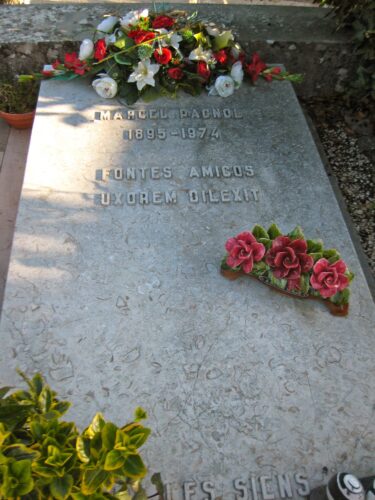
- Pagnol grave
-
- Picnic above La Treille
-
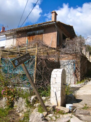
- Bastide Neuve – Pagnol family holiday house at La Treille
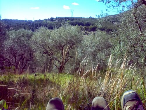
The Marcel Pagnol walk is well signed and passes through the back streets of la Treille, past a fountain and the follows a steep road (a cul-de-sac) up the hill to Bellons. La Bastide Neuve is beside the small road. We stopped for a picnic near there.
The road soon peters out and we followed a track still climbing steeply to the peak called la tête ronde where the path branches and we continued to Pas de Loup. At the end of Taoumé we took the path towards the peak round the back with the hope of finding la grotte du “Grosibou” where Pagnol and his friend Lili des Bellons were terrified by the giant owl. We were near at about 600m but failed to find the cave.
-
- Yellow iris
-

- On the path to the Pic du Taoumé
-
- Vallon de Passe-Temps
-

- Pic du Taoumé
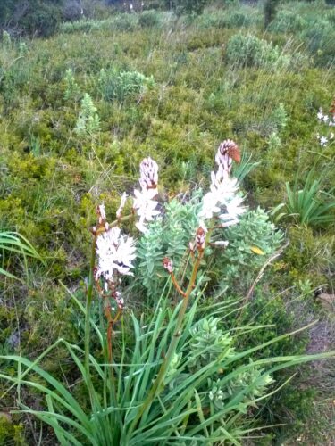
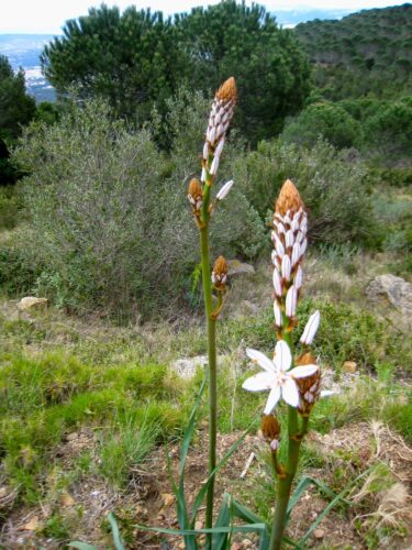
This walk gave us some idea of the landscape that is the main setting for the books in the series “Souvenirs d’enfance” : at this time of year gorse, many bushes we couldn’t recognise and a few yellow irises in flower. Since the books are full of descriptions of trapping birds we were surprised not to see any (not even a thrush). Did the Pagnol family exterminate them?
It was a long walk down but the little bus took us back to Aubagne and the 68 to Cassis. We said “goodbye” to Josette Bert as we would be leaving early next morning.
Good but inexpensive meal at the unpretentious La Place on the left facing the Port.
Saturday 28th March. Return to London
Le Corbusier and then a train journey
We had good warning that the trains between Cassis and Marseille were not running due to improvements works. So we took the 7:45 bus to Marseille which would arrive long before the Paris TGV at 10:30. This was very convenient as the bus stop is right outside the studio. It was also very pleasant as the route goes along the coast instead of the inland route taken by the train.
We had noted that one of the bus stops in Marseille was labelled “Le Corbusier” so we decided we would take the chance to visit the Cité Radieuse, the first of the housing blocks (or Unités d’Habitation) designed and built by le Corbusier – this one was completed in 1952.
-

- Corbusier’s Cité Radieuse
-
- Corbusier’s Modulor
-

- Corbusier’s Cité Radieuse
Sixty years later, the building looked quite “normal” to us as we approached: but then we had become used to Brutalist architecture in the sixties and many of the concepts are quite commonplace now. But on closer inspection, it is easy to see that the shuttered concrete (béton brut) and the pilotti were very innovative in the early fifties. And the proportions are very pleasing and the use of mainly primary colours quite effective in a cubist sort of way.
-

- Cité Radieuse interior
-

- Cité Radieuse ‘Rue’
-

- Cité Radieuse ‘Rue’
We wandered into the main entrance and a very nice man behind the desk asked what we wanted, so we said we’d hoped to see the building (it was well before opening time and even longer until a guided tour). But he just thrust forward a printed page and said: “read this” and then pushed out a book and said: “sign here”. We were then free to take the lift and look around.
We went first to the third floor where there is a ‘shopping street’: a long corridor going from one end to the other of the building; there are still a few shops (e.g. florist, dry cleaner) and a reception for the small hotel that occupies some of the flats. The details of specially designed lamps and little coloured glass panels in concrete walls were very pleasing.
-

- Cité Radieuse roof
-

- Cité Radieuse roof
-

- Cité Radieuse roof
-

- Cité Radieuse roof
Then we went to the roof terrace which hosts two sculptural ventilation shafts, a childrens’ play area and paddling pool and clear views through narrow slits of the Mediterranean, the hills behind and Marseille itself.
Then we walked to the metro station at Rondpoint du Prado. Took the metro to St Charles Station, bought sandwiches and soon boarded the TGV. These double decker trains are very comfortable and this one went non-stop to Paris Gare de Lyon in about 3 hours. Then we retraced our route via Gare du Nord and St Pancras International and the 390 bus finally arrived home at about 6pm.