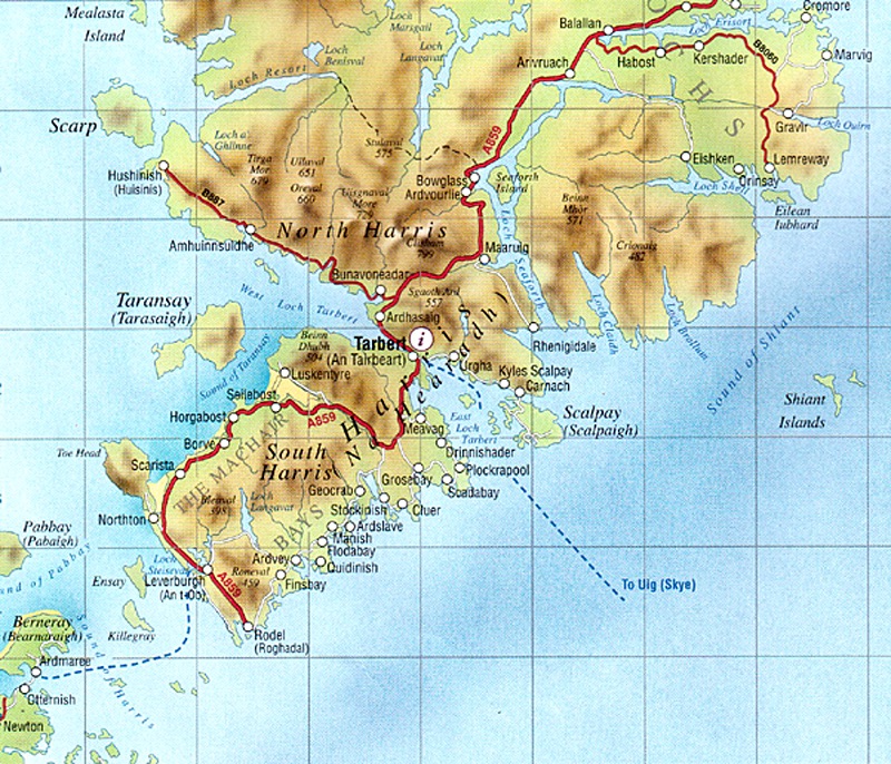
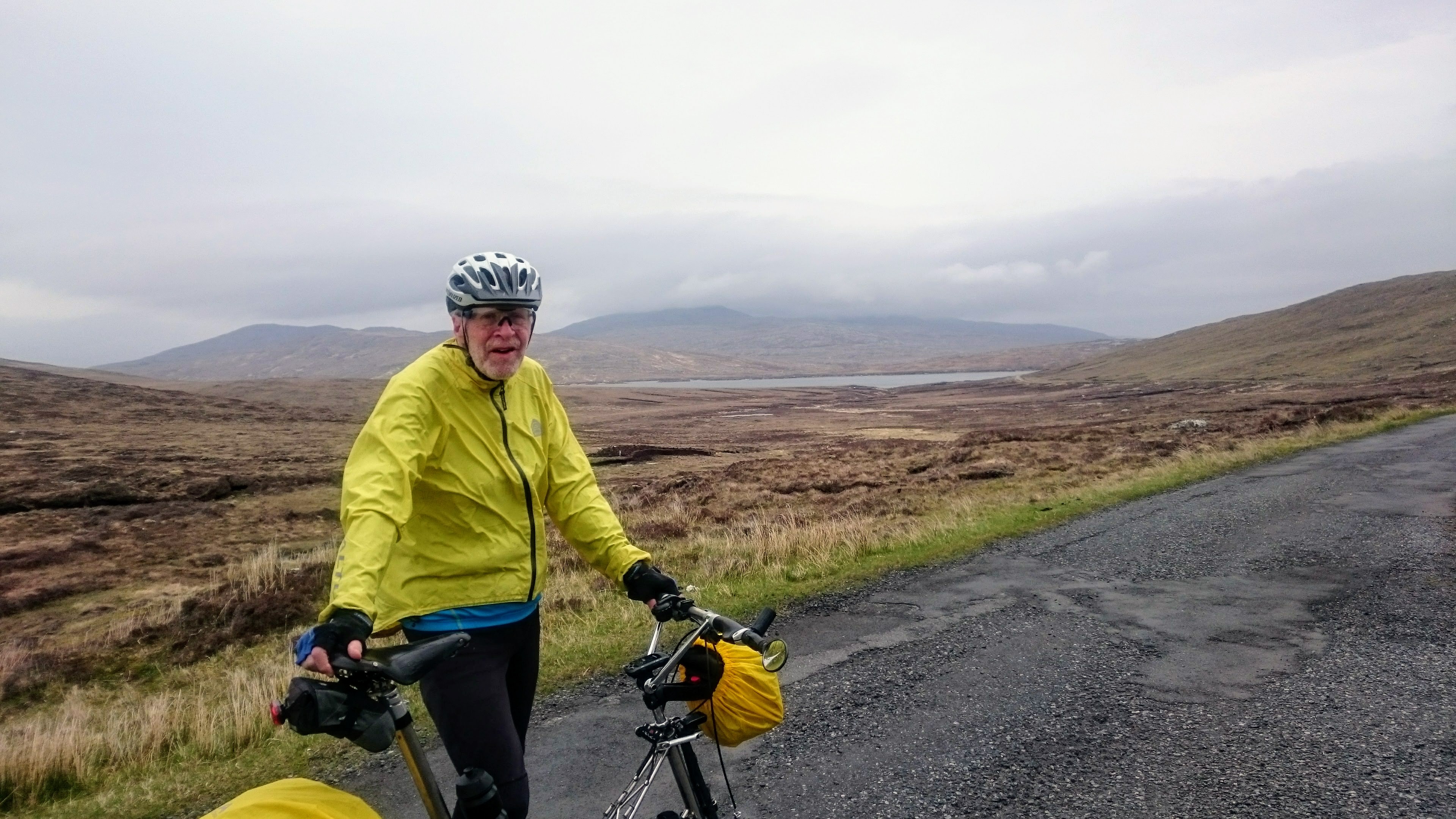
Cycling in the Western Isles, 13th-29th May, 2018

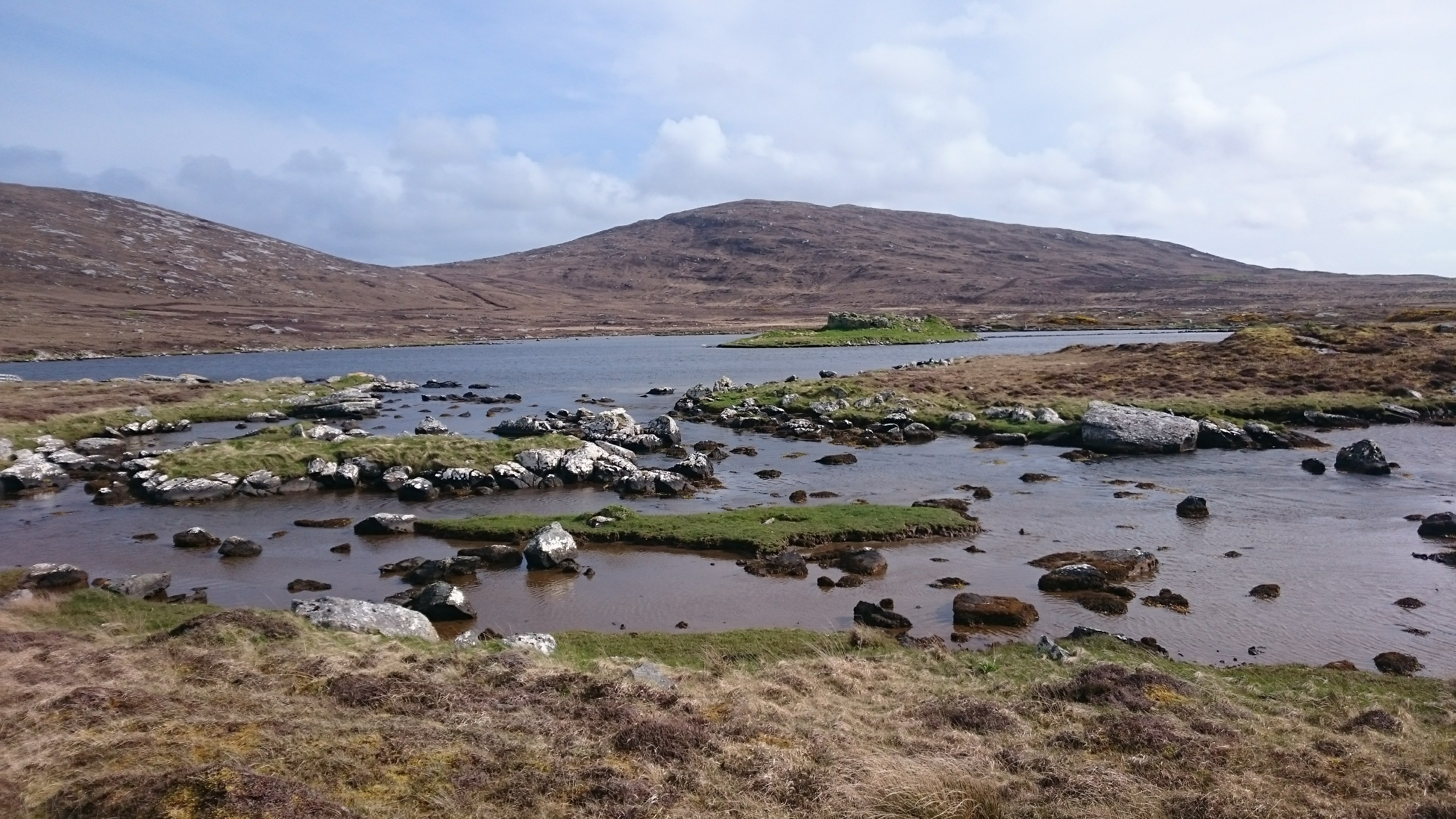
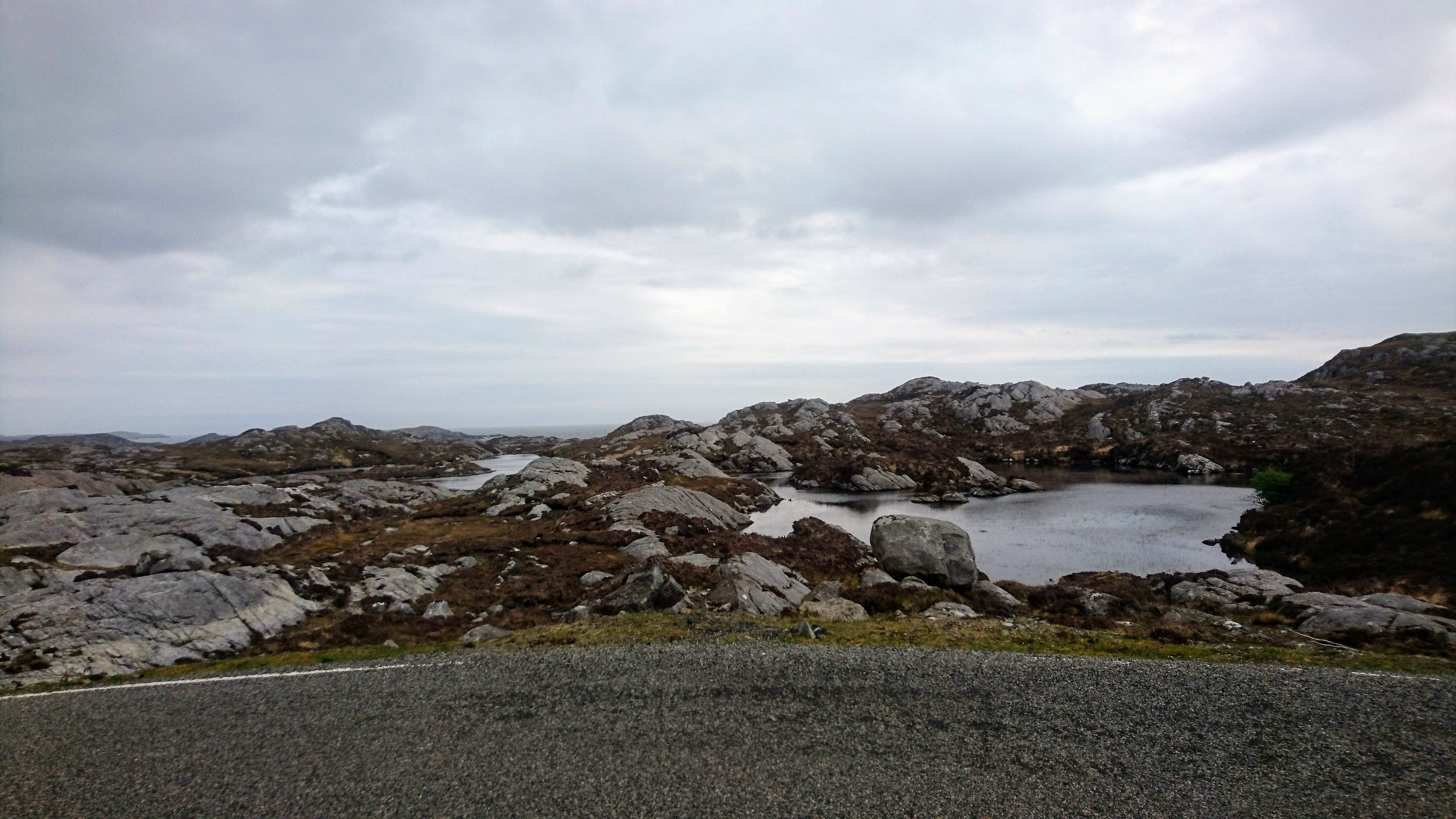
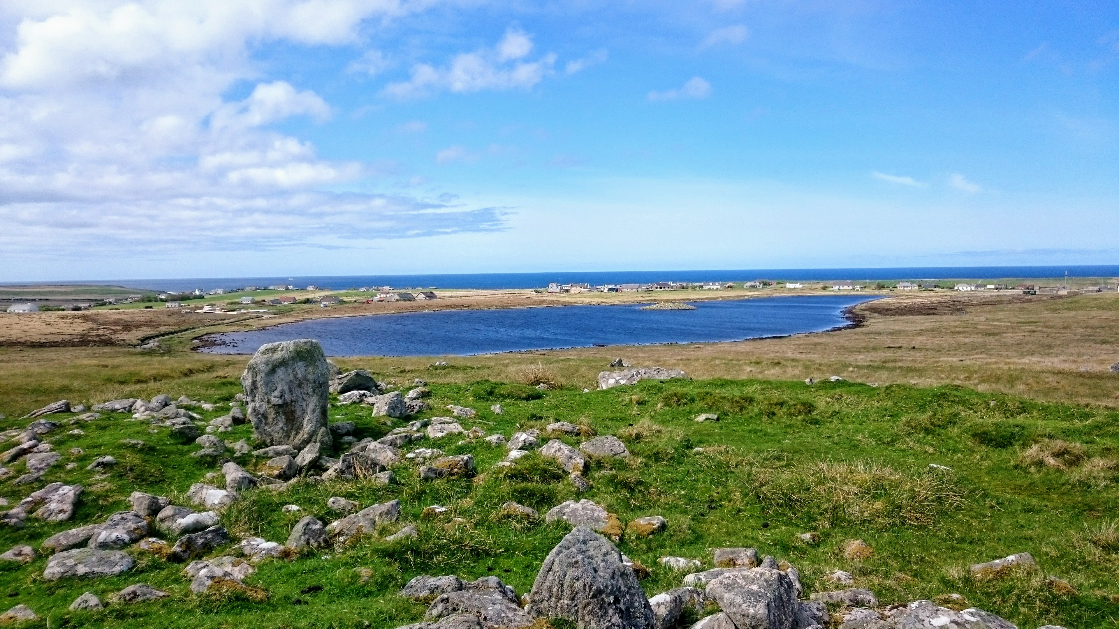
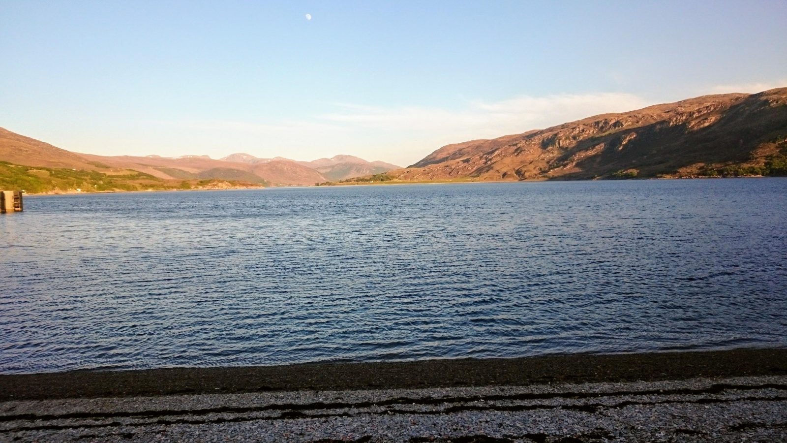
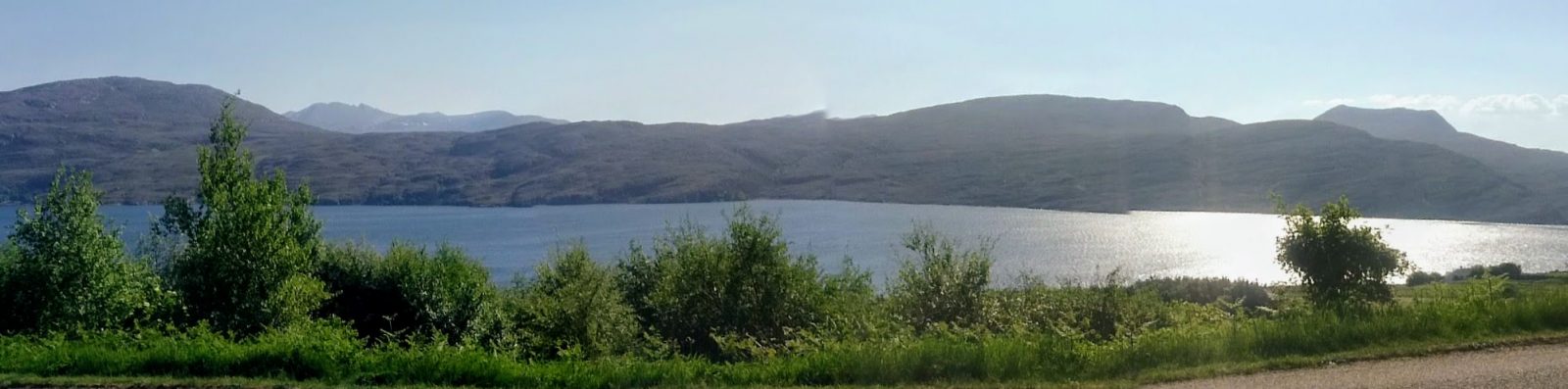
Berneray Loch
See our Photo Album on Google Photos
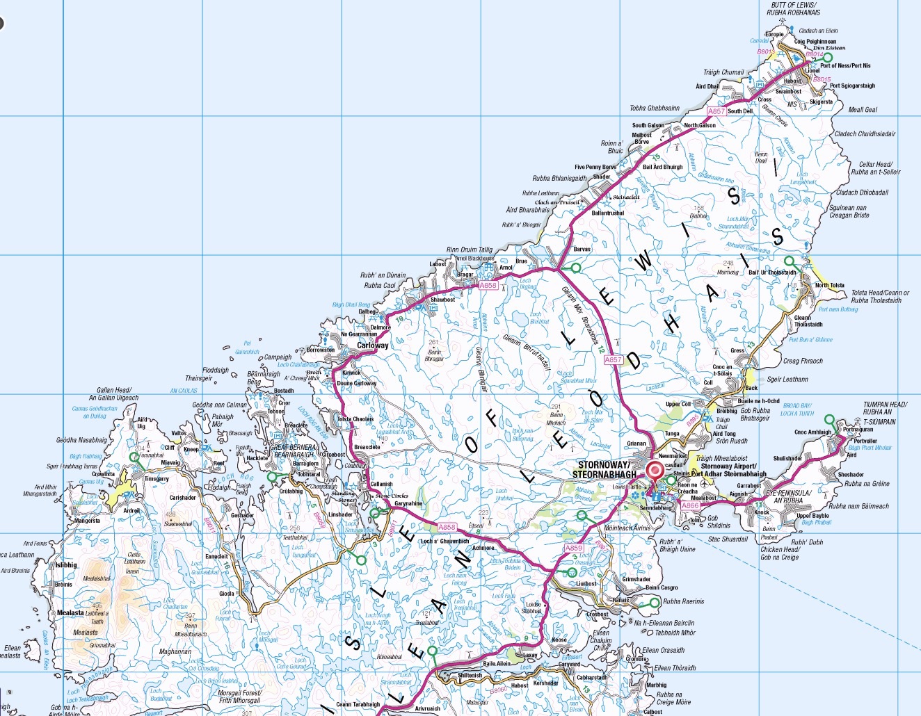
Total distance cycled, including day rides was 323 km = 201 miles.
Sunday 13th May – sleeper train to Inverness
We took the sleeper train leaving Euston at 8:28 pm and were astonished to observe that the diverted route on Sundays goes via Wembley and Camden Road to get across to the East Coast mainline somewhere near to Kings Cross – but then we fell asleep.
Monday 14th May – local train from Inverness to Kyle and then cycle to Portree on Skye
The sleeper train’s porridge was good so we decided to save the sandwiches we had brough for breakfast until later. At Inverness we had been told the Kyle train was on the next platform and boarded a train to Aberdeen but eventually managed to find the right train at the last minute. This Inverness – Kyle route runs right across Scotland, passing through lovely countryside with views of Loch Ness and the Cairngorms. The last section goes through Strathcarron and alongside Loch Carron, somewhere we had stayed during our tandem tour of Skye, Applecross and Torridon in 2011.
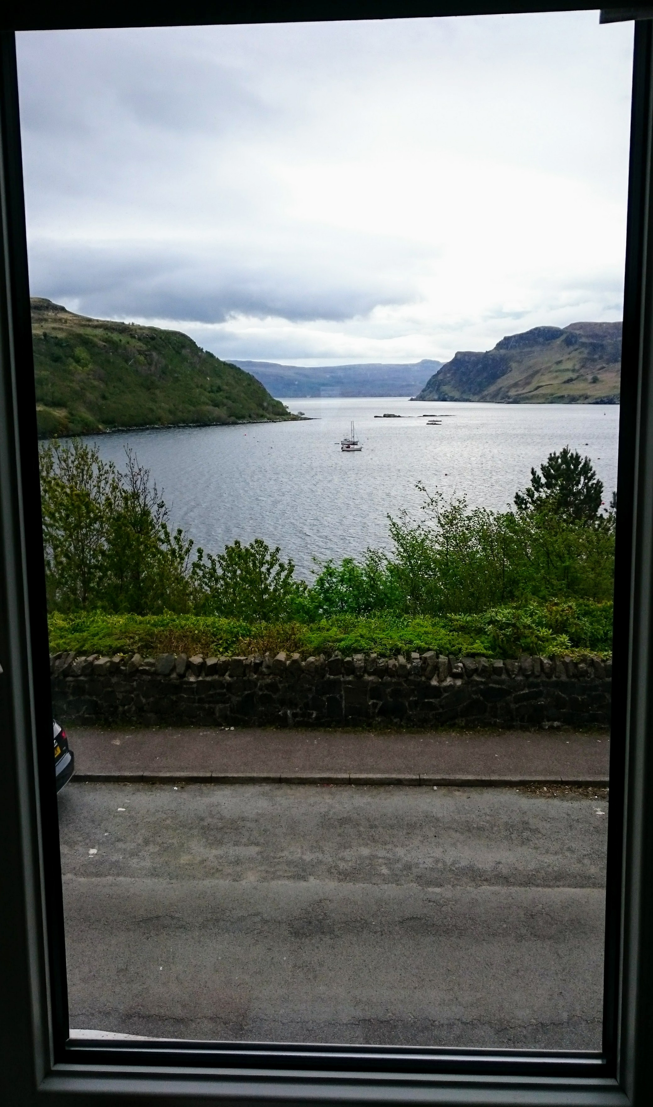
View from our room at Rockview B and B, Portree
At Kyle, we mounted our loaded bikes and tackled the high bridge over the Kyle of Lochalsh riding on the footway. The wind was soft today so the experience was much better than our last crossing of this bridge in 2011. For most of the day’s journey, the only available road was the main road so we had to use that and suffer the noise and hassle of being passed continouusly by motor vehicles. Tourists are being drawn to drive around Scotland by advertising of the North Coast 500, that goes includes many of our secret places e.g. Applecross and Troon.
We stopped at the Coop above Broadford Bay to buy some fruit and then found a pleasant spot to eat the omelette sandwiches. We chatted with some french tourists in a van who were on the North Coast 500 to which they had added a visit to Skye. We got going again, up a big hill, realising too late that we could have left the main road to take a quiet alternative round the coast at Loch Ainort with less climbing as very little traffic.
We stopped for tea and scones at the Sligachan Hotel before doing the final ride up to Portree. This is an attractive small town on the edge of the bay – our room at Rockview B and B looked out over this bay.
Distance cycled: 57 km
Tuesday 15th May – via Uig and Lochmaddy to Berneray
From Portree to Uig, we had a very wet and windy ride over wild moorland. George had a back wheel puncture right opposite a bus shelter where we fixed it. We had a good lunch and partially dried out in The Sheiling & Ella’s Cafe by the port. The Sheiling is a lovely family-run vegetarian restaurant with an attached shop selling 1950’s memorabilia.
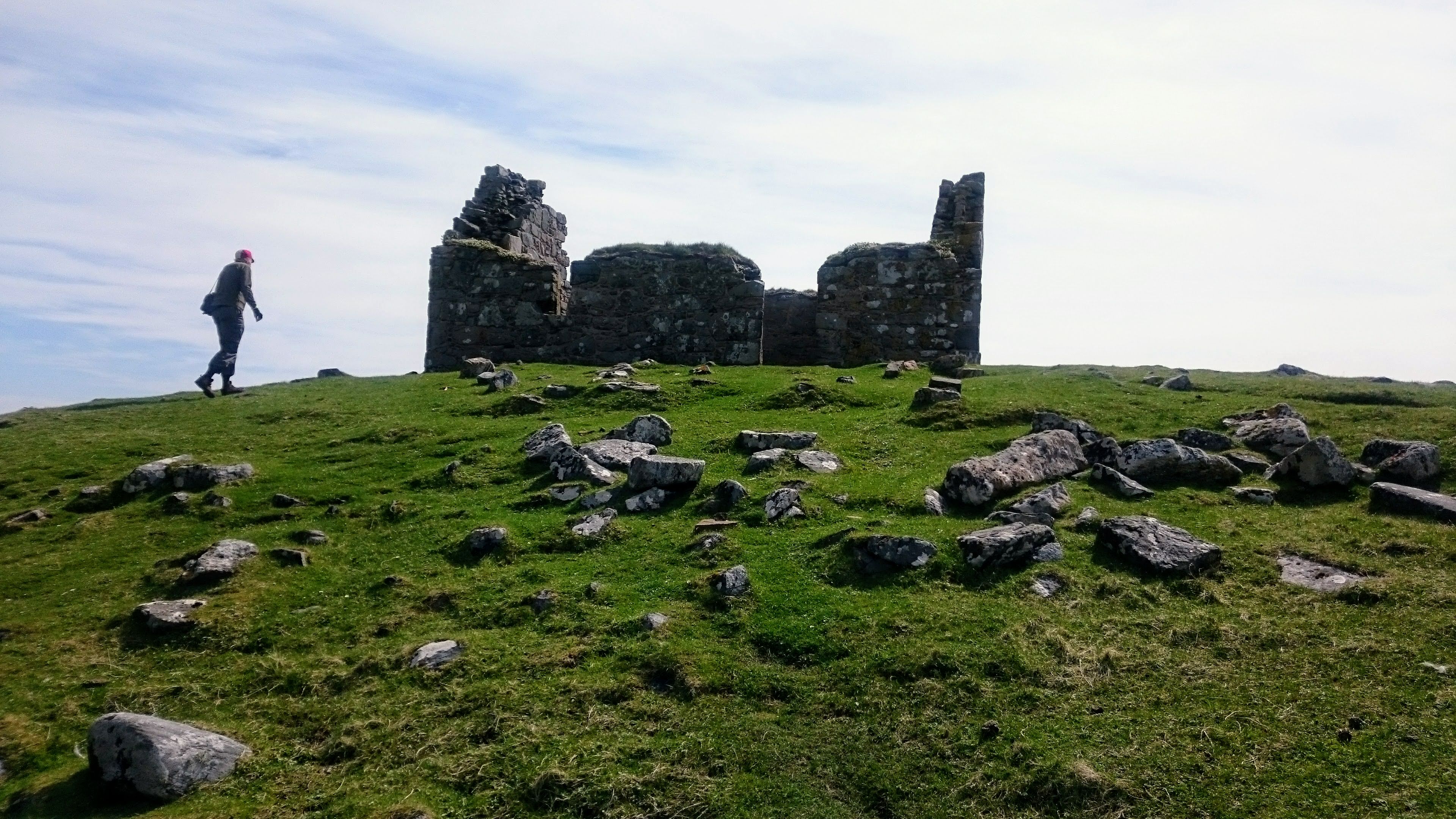
Dun an Sticir (on the island in the distance)
The boat trip over to North Uist took a little under two hours. As we approached Lochmaddy, the rain stopped. We set off on a lovely bike ride on narrow roads over beautiful moorland past ponds and bays. Our first stop was at Dun an Sticir, an Iron Age broch on an island in a lake with a stone causeway leading from one side of the lake to the island and a second linking the island to the other side of the lake.
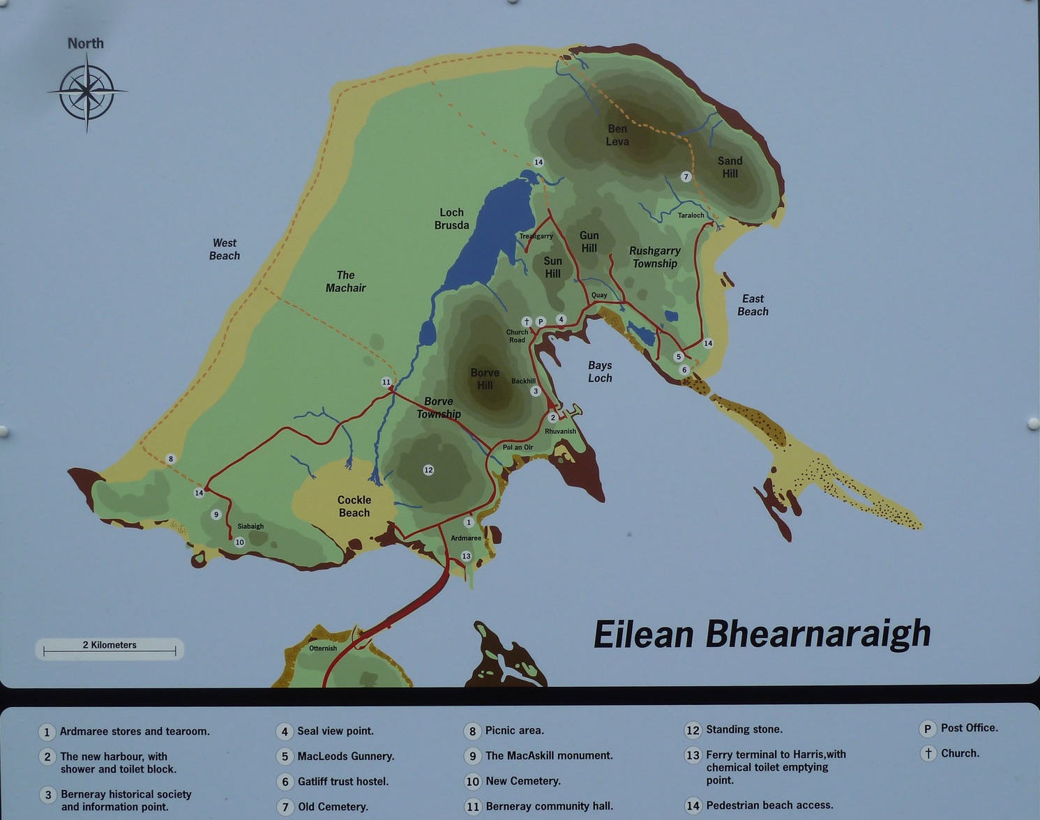
A couple of miles further on we came to the causeway that crosses from North Uist to the south-east corner of Berneray. The causeway wasn’t there last time we came (25 years ago) – visitors to Berneray had to travel there by boat and without cars. So the causeway has dramatically changed the feel of Berneray; the residents are still charming and open, but we think visitors’ cars and camper vans should be confined to a car park near the end of the causeway. That’s not entirely a fantasy, it’s the way some popular villages in Cornwall such as Polperro and Fowey have had to defend the charm that attracts their visitors.
We were late to get to the shop but they agreed to let us grab a few basic stores for our evening
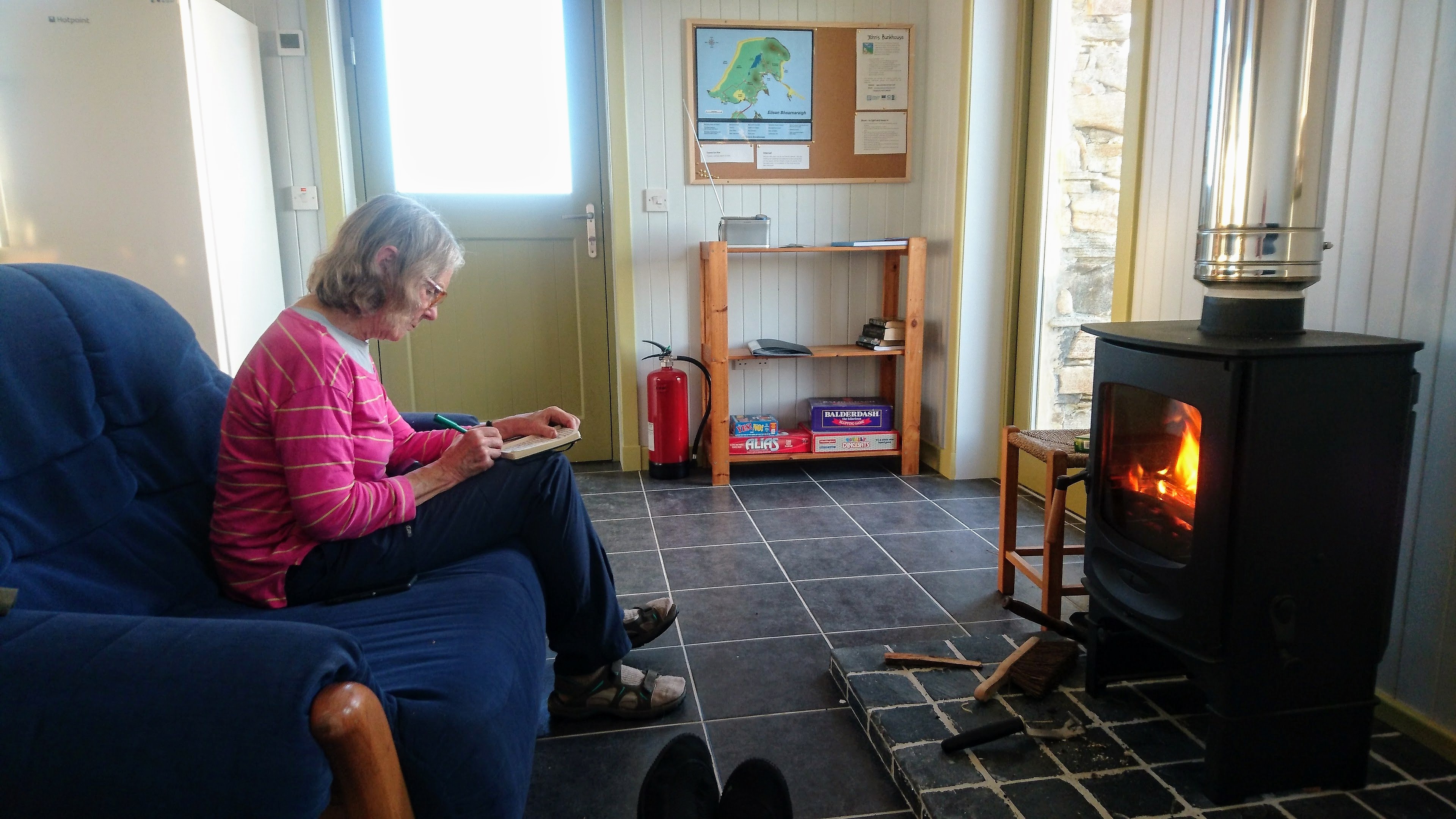
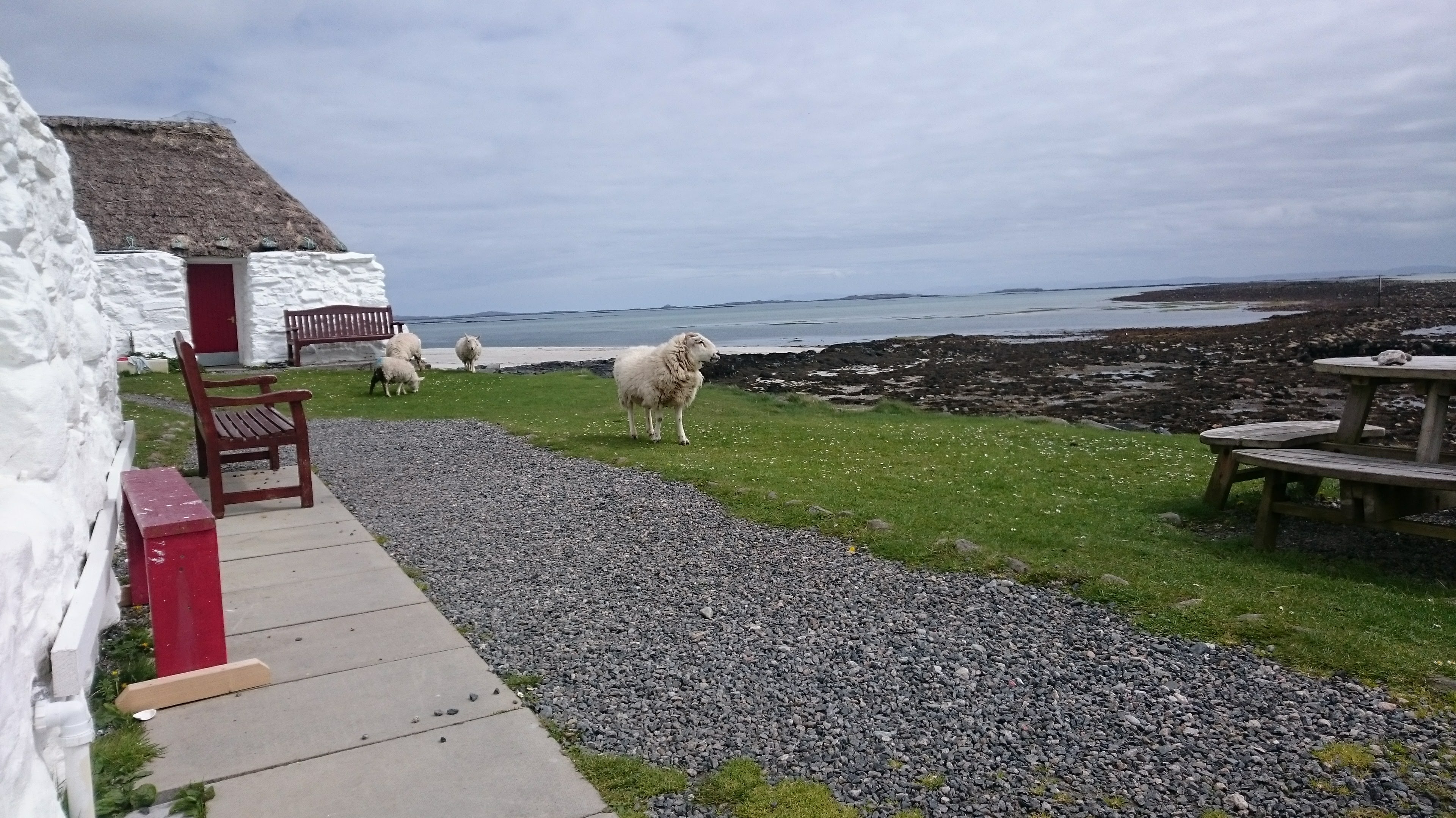
In John’s Bunkhouse on Berneray
meal and breakfast. The brand new bunkhouse is right by the shore not far from the end of the causeway. The wardens, Mary and Chris were very welcoming. We were fortunate to have lower bunks in an ensuite 4 person room all to ourselves.
John’s Bunkhouse. Very comfortable with well-equipped kitchen and a peat stove. It is situated at the end of the road by the Cockle Beach but isn’t shown on the map as it opened only this May.
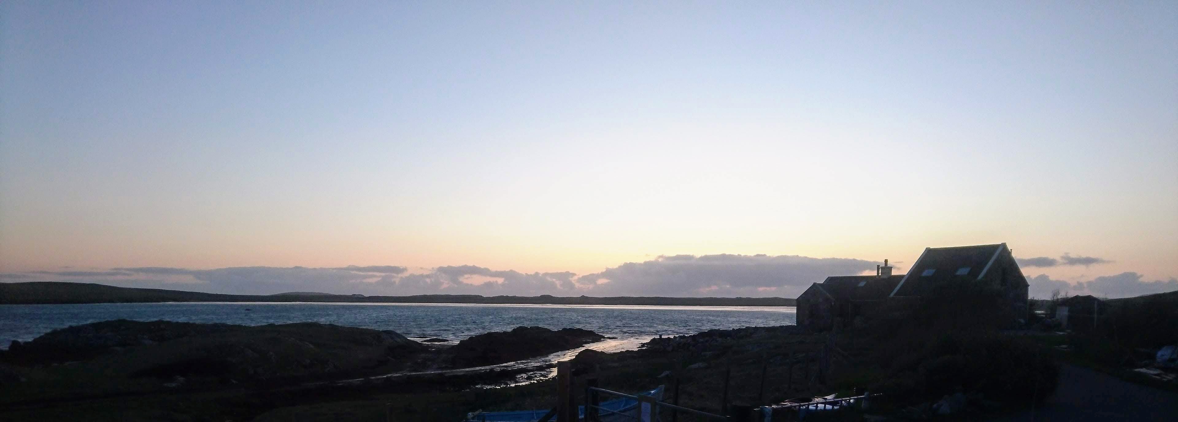
Sunset over John’s Bunkhouse on Berneray
Distance cycled: 44 km
Wednesday 16th May – explore Berneray and then on to Scarista
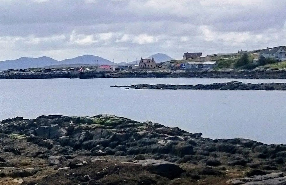
Seal viewing point in Berneray Harbour
We bought picnic food from the little shop and then rode our bikes over every road on the island. We stopped at the seal view point in the bay beyond the old harbour where we did indeed see lots of grey seals and white seals.
Our next stop was at the Gatliff Trust hostel where we had stayed in ’93 and in ’89. We went inside and were pleased to find that the communal kitchen and dining room and dormitories seem not to have changed much. The hostel is beautifully situated on the shore at the corner of East beach, about three miles from the causeway and away from any road. We sat in the sunshine outside the hostel chatting with people staying there and eating our lunch. Long may the Gatliffe Trust continue to enable people of all ages and origins to live in this former blackhouse.
The Gatliffe Trust hostel on Berneray
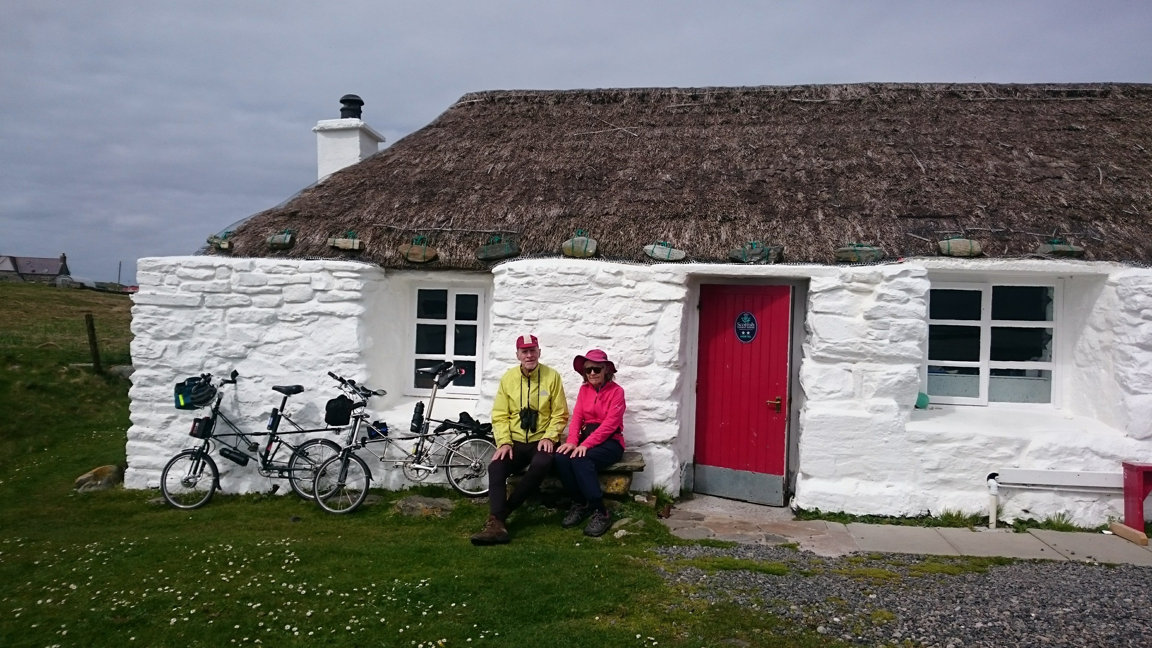
Lunch outside the Gatliff Trust Hostel
We then followed the road to the end of East Beach, noting with disgust that people were parking camper vans on the machair beside the beach. That didn’t happen before the causeway was built.
On our return we went up the road between Gun Hill and Sun Hill and stopped by Loch Brusda to enjoy the view across the machair and over West Beach. We also went into the ‘Nurses House’ which is now the visitor centre run by the Berneray Historical Society. We learned that the causeway has done a lot to improve life for the islanders, for example, women are able to get jobs and children can go to day school in Lochmaddy rather than being weekly boarders.
We took the last boat from Berneray to Leverburgh in South Harris. This ferry follows a winding course between green and red buoys, avoiding the many islands and smaller hazards as it crosses the sound of Harris.
The ferry’s departure had been delayed by the tides but it arrived just in time for the table we had booked at the Anchorage Restaurant just by the port at Leverburgh. We had a very good seafood meal (seafood chowder and langoustines) and then rode to Scarista (which is at the south-west corner of the West Coast of Harris). In our post-prandial enthusiasm we accidentally followed a signpost suggesting a walking route to Scarista up the Peat Road across the centre of Harris and after going up a fairly steep hill we had to retrace our tracks, making the journey longer than expected (10 miles) and dusk was descending as we arrived at about 10 pm – our hosts having almost given up on us.
We stayed at Sandview House, Scarista, for two nights. This house faces the beautiful sandy beach which is about 100m away across the machair. We could enjoy the view of the beach with the island of Taransay beyond from our bedroom window and also from the dining room. Mary Anne and Donald MacSween are very friendly and traditional Highland hosts.
Distance cycled: 15 km
Thursday 16th May – Scarista and Northam
We chose to stay in Scarista as we had spent a few days there during our visit in 1989 sheltering from stormy weather. We remembered the beautiful sandy beach and the machair but we were unable to locate the house where we stayed last time.
Scarista Beach
Soon after breakfast, we walked to the beach, approaching it across the machair which was being kept trimmed by sheep and lambs. Then we went over the dunes onto the beautiful white sand – made from crushed sea shells. It was low tide and long rolling waves were breaking on the shore. It was a fine sunny day but the strong southerly wind deterred us from testing the water.
We took a short cycle trip to Northam and on to the Toe Head promontory which had always looked interesting – and we were not disappointed. We had lunch in the Temple Café. It’s in a little stone building recently-built in the style of a Hebridean black house with a conservatory roof. It serves delicious homemade cakes, soups, and salads and it was heaving with visitors. We chatted with a couple of keen cyclists who had relocated from Yorkshire to Fort William years ago for love of the landscape. When not working they travel in a mobile home and make many cycle trips on tandem and solo bikes.
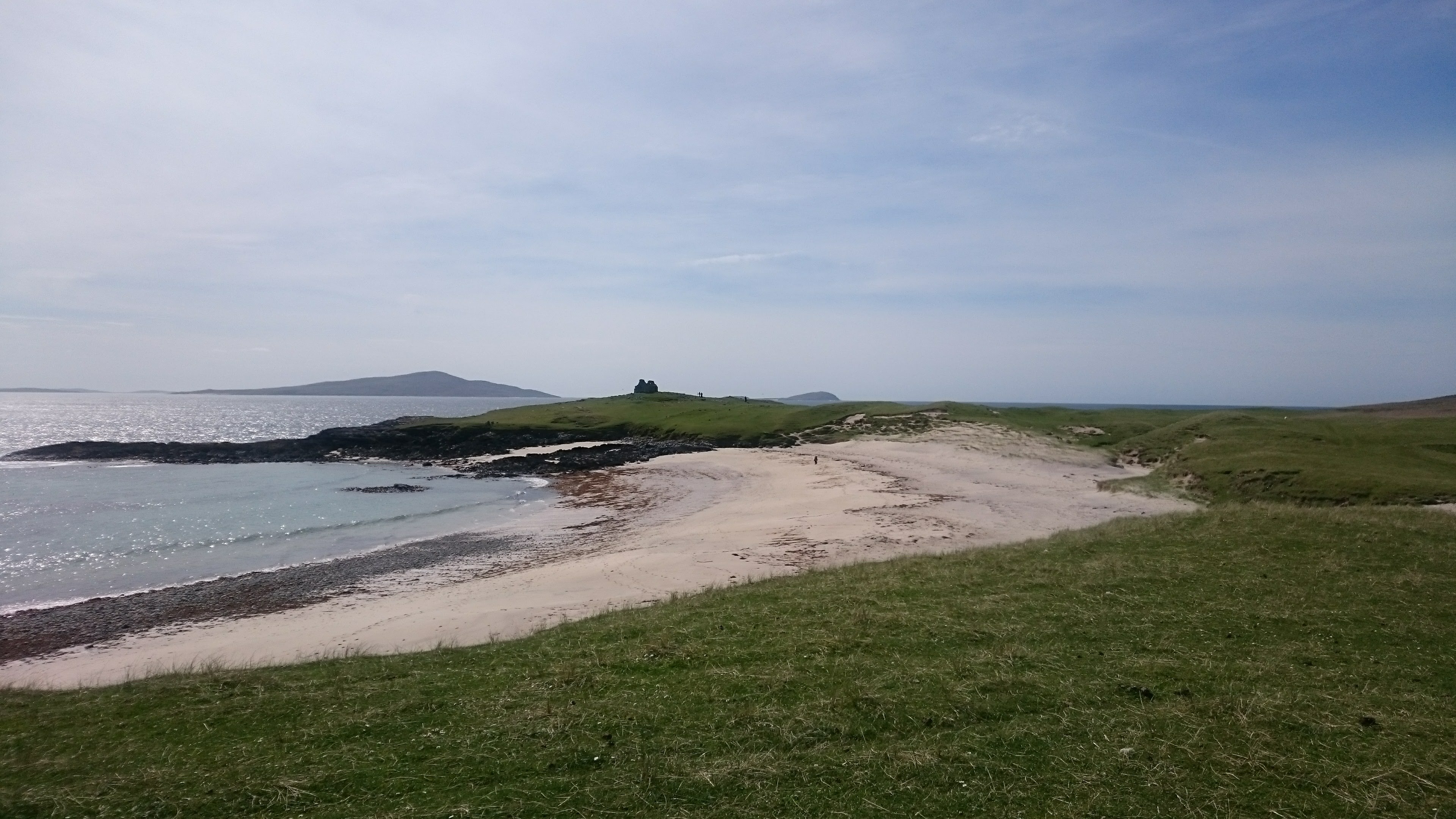
Old Chapel at Toe Head
After lunch we set out on the track leading to the Old Chapel (Rudh’an Teampuill) and when the surface became too rough we locked the bikes to a fence and walked the rest of the way. The now roofless mediaeval chapel was built over a former broch. It is on a cliff with views over rocky bays with sandy beaches.
We stopped at Croft36 to buy some ingredients for our evening meal. There was nobody there – you just make a choice and leave the payment. Finally we made a rewarding visit to the Seallam! Visitor Centre in Northton which is full of detailed histories of the difficult lives of local residents over the centuries.
We had lovely views of the long sandy beaches of West Harris as we cycled back into Scarista.
Friday 17th May – East coast of Harris and Tarbert
From the Peat Road
We went back to Leverburgh so that we could ride the Peat Road and then the so-called Golden Road on the east coast of Harris. As it was cold and rain was falling we accepted an invitation to tea and cake in the Leverburgh Free Church. While there, we were pleased to be able to find out news of the lady who ran the B and B where we stayed in Finsbay in 1993 who we remembered mainly for serving us ‘special muesli’ instead of the usual ‘full scottish breakfast’.
The Peat Road is a tiny meandering road that runs over the moorland between Leverburgh and Finsbay, crossing vast bogs where peat is still being cut for fuel. The moors appear to roll, while continuously revealing rocks, dry heather, big lochs and peat banks. We had very special memories from 1993 and had been horrified by the proposals to build a ‘super quarry’ and then very relieved to hear that the project had been dropped.
On the Golden Road from Leverburgh to Tarbert
The Golden Road winds and twists along the east coast of Harris which is indented by a series of miniature fjords. It is a single track road connecting the tiny hamlets with names such as Quidinish, Manish, Flodabay and Geocrab – whether these are Gaelic or Viking, we really don’t know. The scenery is spectacular and reminiscent of a ‘lunar’ landscape. We understand that it’s called the Golden Road because of the huge cost of constructing it.
We called on our landlady of 1993 at the Finsbay Art gallery which now occupies the guest bedroom at the former B and B. She has an interesting collection of paintings by artists mainly from Harris and Norfolk. She was very friendly and let us look at the kitchen which hasn’t changed. She also told us that the bay has sixty seals this year so when we left her, we stopped for a look and it was easy to count at least thirty.
Wet riding on the Golden Road
A further five miles along the road, after many turns and many ups and downs, we stopped for lunch at the Skoon Art Cafe at Geocrab for lunch. The soup, bread, coffee and cake were very good. The walls were covered with paintings of views of Harris by the owner, Andrew John Craig whose studio is next door to the café.
The remainder of the ride was quite hard work with having to climb all the hills between the bays but the views were very rewarding until we joined the main road where there was more traffic to look out for. Eventually we reached Tarbert by about 4pm.
We planned to stay for two nights in Tarbert to allow us time to explore the area. As we weren’t able to find anywhere with two nights we spent the first in the Harris Hotel and the second at Avalon B & B. Tarbert is the main town on Harris but it a surprisingly small place nevertheless. We chose to eat dinner in the Harris Hotel on both nights – the menu seemed unexciting but we were very satisfied with the seafood dishes we chose. Over dinner on our second night in Tarbert we chattered with another pair of independent cyclists – Roderick and Clare from Oxford who told us they are tandem touring enthusiasts and we found plenty in common to talk about.
Harris Hotel This is an old family run hotel in a nice white building with a big garden in front. It is situated in a dip so you never know that there’s a strong wind blowing through the town. They have a tiny ‘bike shed’ out the back where space is shared with a washing machine. But they were very hospitable when we returned on the second day totally soaked, even though we were no longer guests at the hotel.
Distance cycled: 42 km
Saturday 18th May – to the Eagle Observatory
On the road to Meaviag and the Eagle observatory
As everything is closed on Sundays, we shopped for picnic supplies for this and the next day.
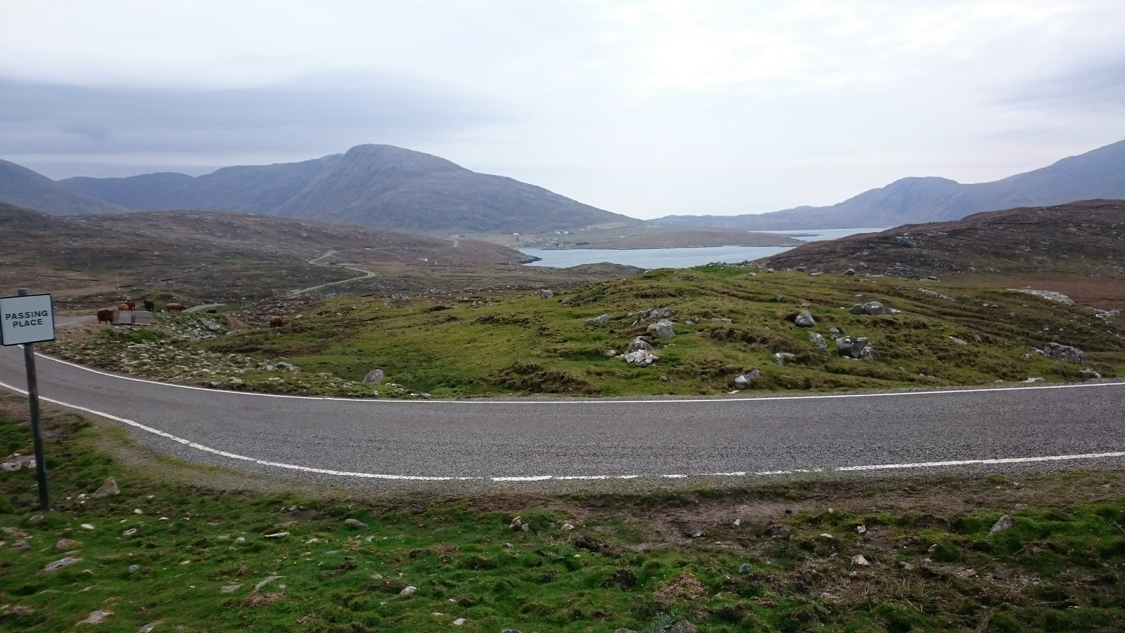
The Eagle Observatory is accessed via a 2km track along Glenn Meavaig, beginning about half way along the road to Hushinish – that’s the road that runs along the south-west coast of North Harris. To get there we rode about three miles along the main road from Tarbert to north Harris and then turned onto a hilly minor road along the coast for another five miles.
This road winds round the many bays, mounting a hill and going down again between each pair of bays. On the either side of the estuary we could see the shore of South Harris. We passed a tall chimney from some former whaling station and then passed through the scattered houses at Bun Abhain Eadana. Then we saw a waterfall plunging down some black rocks. After that, it was just landscape: rocks, grass and the shore. Then a lonely cattle farm beside the road. Eventually, after a very big climb and a long descent we found ourselves at the track up to the Eagle Observatory. It’s at the head of the sea loch at Meavaig.
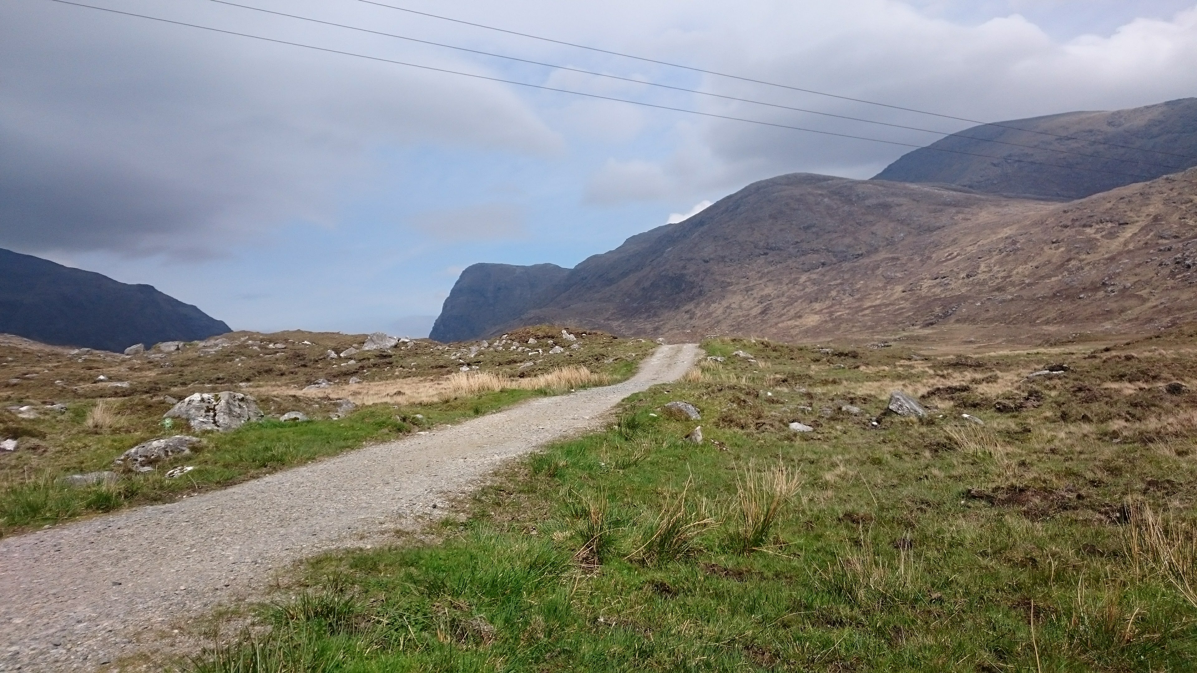
The track up to the Eagle observatory
By now it was 1:30 pm so we ate our sandwiches in the shelter of a stone wall at the foot of the track. Several people who had come by car were coming back down the track and none of them had managed to see a Golden Eagle. We found the track rough for cycling so locked the bikes and walked about 1km up the track, eventually deciding to abandon our search for the Golden Eagles. But we did see a heron as we came back down again!
The wind was getting up and it was a bit destabilising as we retraced our ride back to Tarbert. After going on to the main road, we stopped for tea and scones at the Hebscape gallery at Arthasaig. The scones were excellent. The art consisted of ‘giclee’ prints of photos by Denver Cole – over-brightened pictures of local views.
After a meal at the Harris Hotel, we moved into Avalon which is on the north edge of Tarbert right by the bay. We had a lovely view of West Loch Tarbert from our window
Avalon Guest House The landlady, Arlene Morrison was very welcoming and let us put our bikes in her shed. It turned out that almost all the guests were cycling. The next morning we had an excellent breakfast. This B and B is in a good situation, just outside Tarbert and with unbeatable views over a very peaceful West Loch Tarbert.
Distance cycled: 24 km
Sunday 20 May. Tarbert to Loch Erisort
After an excellent breakfast, we said ‘good bye’ to Arlene Morrison and set off in heavy rain up the road to the north. We were heading to Balallan on Loch Erisort – at the top right of the Harris map above.
We had the wind behind us and all went well as far as the Hushinish turning. We talked to some other cyclists who were retreating on foot back to Tarbert but didn’t really understand the problem. We set off up the hill on the main road to North Harris but when we turned a corner we were hit by a very strong wind rushing through a gap and straight across us.
After struggling for a while, George was blown over and Jean’s helmet and bag covers were blown away. We decided to return to the Harris Hotel and ask them to order a big taxi to take us to Loch Erisort. Like the cyclists we had passed earlier, we had to walk much of the way back.
At the hotel, we changed our clothes and partially dried our waterproofs and warmed ourselves with hot chocolate followed by soup and bread. At about 3 pm the taxi arrived – it was large enough to stand out two bikes in the back. The driver, Steve, was very good – a Glaswegian who came to the islands to work on fish farms. Visibility was poor so we didn’t see the views of Loch Seaforth that we recalled from our last ride up here.
Irene MacKay welcomed us to ClearView with tea and cake. She had offered to take us to Loch Erisort Inn for an evening meal but we decided to stay in. She provided us with plates, cutlery and glasses so that we could eat our still unconsumed picnic lunch.
We browsed the family photographs and books including in particular Peter May’s Hebrides.
We then looked at the weather forecast (heavy rain all day Monday with the wind in the wrong direction) and decided to change our plans for the next day.
ClearView at Balallan Comfortable sitting room with books. Welcome with tea and cake. Views over Loch Erisort.
Monday 21 May. Loch Erisort to Stornoway
The plan for Monday had been to cycle from Balallan on Loch Erisort via Callanish to Bragar on the northwest coast of Lewis. We were booked into a Shepherd’s Hut and were worried that if we managed to arrive there we would be unable to get dry. We even doubted that we could cycle the odd 30 miles in the bad weather conditions. Therefore, we decided to cancel the Shepherds Hut and spend the Monday night in Stornoway instead. We managed to book accommodation in Stornoway after making many phone calls.
Rainy weather at Clearview, on Loch Erisort
We took the first bus from Balallan to Stornoway. The bus’s hold was already crammed with bikes and luggage of others avoiding the bad weather but the driver managed to add our bikes. We had to hold on to our bags and George’s bike suffered a bent gear mech. On arrival at Stornoway, we moved into a small flat belonging to the Hebridean Guest house – they usually let the flat for periods of a week but we gratefully accepted the offer of a 24 hour let.
The flat gave us the space and warmth we needed to recover from colds we had picked up and to dry out. As soon as we reached Stornoway the weather improved and we spent the afternoon exploring the town, which appeared a much more prosperous and liveable place (pop. 8,000) than it had on a previous visit years ago, with improvements in the urban environment and new attractions, many funded by European Union grants.
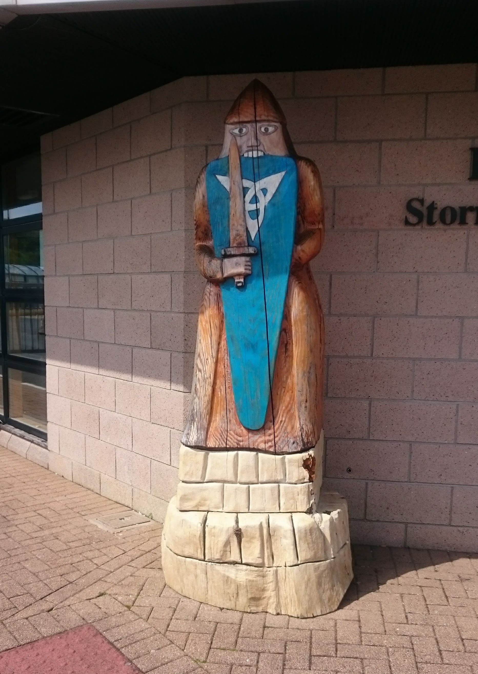
Beserker (Norse warrior) representing the rook
We walked to the Lews Castle Museum and were impressed with its modern and comprehensive displays on the landscape of Lewis its culture and history. The highlights were a sequence of very good 3D panoramic videos of Lewis landscape and a collection of interviews of local people in Gaelic and English.
They also have six of the 12th-century walrus ivory Lewis chessmen that were discovered in Uig in the 19th Century. Most of the rest of them are in the Britsih Museum with a few in Edinburgh’s Museum of Scotland. There seems to be quite a lot of local consciousness od these chessmen. The one on the right is at the port. We saw others in the grounds of Lews Castle and in a garden in the north of Lewoi.
Tuesday 22 May. Stornoway to North Galston (near Butt of Lewis)
The next day the weather was fine at last – not a sign of rain but cool and with a quite an inconvenient wind. The route for this day involved a crossing over the island of Lewis in a northwesterly direction and then a northeasterly ride up the coast.
The road across the island runs over rather bare peat-bog moorland with a scattering of small lochs, rising gradually to a height of 350 feet with plenty of ups and downs on the way. The descent was against the wind so it was rather slow.
We met the coast at Borve and seemed to head even more into the wind. We stopped for a welcome coffee and a warm-up at the Morven Cafe-Gallery The coffee was really good – made from beans specially ordered from London. The gallery shows some good work – Hebridean landscapes and seascapes.
Dun in Loch Steinacleit viewed from above
Continuing northeast we stopped to walk up to the Steinacleit archeological site. At the top of the hill is a collection of stones, some standing. Some say it may have been a stone circle while others say a prehistoric farm. We found a sheltered spot among the stones and had our picnic lunch.
Below the stones is a ruined Dun on a tiny island in Loch Steinacleit.
We arrived fairly early at Heatherview B & B. The accommodation is in a separate self-contained wing upstairs with a sitting room where Jean relaxed while George rode on to the Butt of Lewis. The trip was an extra 30 kms but he did see both the lighthouse and Port Ness. He also encountered the same pair of cycle tourists we had passed walking back to Tarbert in the gale on Sunday. They were in a small group of cycle tourists who had just completed their Hebridean Way tour (i.e. Barra to the Butt of Lewis) shepherded by a small tour company but riding independently.
Paul Moorby is a chef and he produced a really delicious meal – starting with a Spanish-style seafood and chorizo stew made with freshly-caught local langoustine and shellfish, followed by delicious desserts (lemon posset and brownies). He very generously gave us wine as well. We were replete and slept very soundly in what was probably the remotest overnight point on our route.
Distance cycled: 64 km
Wednesday, 23rd May. Return to Stornoway from North Galston
Paul Moorby served us the best of breakfasts: porridge, home-made yogurt and fruits.
Before the return ride, we went down to the shore at South Galston: an attractive rocky cove with interesting layered rocks on the beach. We identified ringed plovers on the seaweed by the water line.
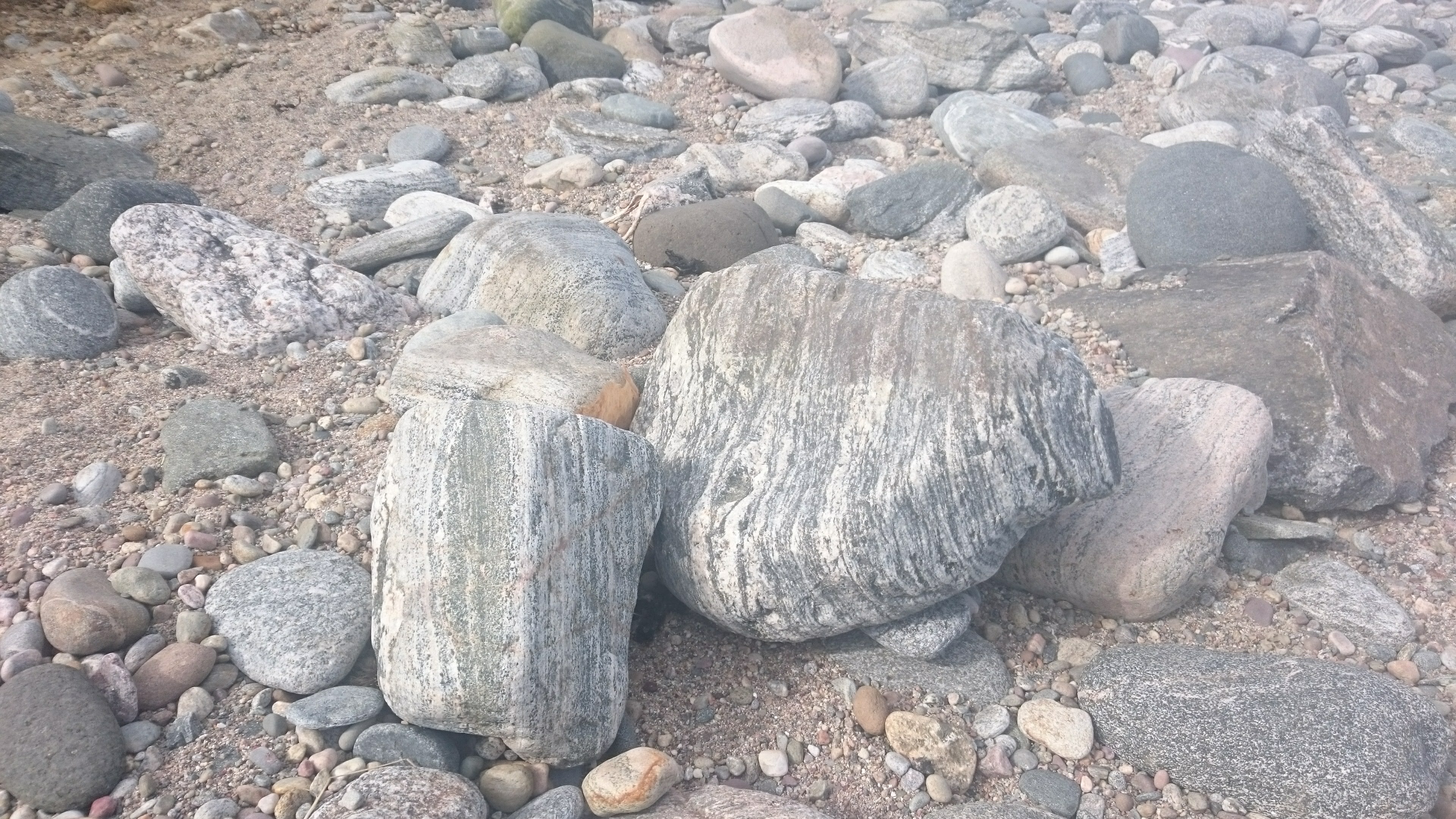
Interesting rocks on South Galston Beach
Then we had a long, long ride through rather featureless landscape: all we could see was green grass on both sides of the road and scatterings of houses. On passing Steinacleit again we noted that the view of the Dun and its causeway was rather better from the road than it had been from above. We stopped for another coffee at Morven gallery.
We then turned left onto the road that crosses the island to Stornaway. Once again we were riding against the wind and were always hoping we’d reached the last summit. We stopped for a picnic in the same sheltered spot where we’d had elevenses the day before.
We stayed in Fernlea Guest House for our two nights in Stornoway. Fernlea is one of the impressive Victorian houses in Matheson Road – a street full of houses constructed by James Matheson with no expense spared using the wealth he had accumulated in the heyday of the Chinese opium trade.
In An Lanntair with the ferry behind us
On both nights, we had an enjoyable evening meal at the An Lanntair Arts Centre. The restaurant is upstairs and has a view over the harbour. We sat and watched the ferry coming in and noted the Herring Girl statue.
View from Woodland Cafe in Lews Castle grounds
Thursday was a sunny day and we took a walk in the extensive wooded grounds of Lews Castle, walking along the edge of the bay, round the end and back through the woods, and then having lunch at the Woodland Cafe. We understand that the mainly deciduous trees grow here because the sheep are kept out – the rest of Lewis is virtually treeless. The castle was also built by James Mattheson in about 1850. He had bought the island of Lewis with the fortune he had made from the Chinese opium trade. The castle and grounds now belong to the council.
On Thursday afternoon, George rode out on the Eye peninsula and looked round the ruins of the mediaeval St Columba’s Ui Church.
Distance cycled: 37 km
Friday 25th – Sunday 27th May. Ullapool
On Friday we took the 2pm ferry from Stornoway to Ullapool – a two-and-a-half-hour voyage. A surprising coincidence was an encounter with an acquaintance and fellow cycling campaigner while waiting to board the ship – Roger Geffen, a senior staff member of Cycling UK who had also been touring the Western Isles on a similar itinerary to ours, but faster.

Ullapool waterfront
After crossing the Minch, the Ullapool ferry passes the Summer Isles and enters Loch Broom – a long sea loch with high mountains on the west side. Ullapool is about a third of the way down the loch on the east shore. Neither of us had seen Ullapool before and right from the start, we agreed it was one of the loveliest places we’d visited. The first impression was of white houses along the loch side sparkling in the sunshine with hills on the other side of the loch apparently almost free of habitations or roads.
The view across Loch Broom from Ullapool
Ladysmith Street, Ullapool
We were surprised to find that the streets were laid out as a grid and that the houses were on spacious plots with wide areas of grass in front. We soon discovered that Ullapool was founded in 1788 as a herring port and that It was designed by Thomas Telford. Each house was to have a plot large enough to grow vegetables and to keep a cow. Although the herrings moved north, there still are fishing boats here, bringing prawns and other shellfish ashore.
We had planned to spend two nights in Ullapool and ride our bikes to Inverness over two days via Altnacealgach and Culrain, but as we were still recovering from the colds we had picked up earlier in the holiday and Ullapool was unexpectedly attractive, we decided to stay there for a third night and then take our bikes on a CityLink bus to Inverness (having heard about that option from Roger Geffen). We spent the first two nights at the very comfortable Broomvale B and B with Sara and Alan who are very friendly hosts. They helped us to organise our travel to Inverness and found us accommodation for a third night across the street from them at Eilean Donan Guest House.
Telford Chapel, Ullapool
We explored Ullapool and walked the shoreline nearby, ate good evening meals at The Ferryboat Inn, The Ceilidh Place (our favourite) and The Arch Inn and generally enjoyed the feel of the place – more relaxed than Stornoway and well-equipped with shops, a small but interesting museum in a very pleasing simple church building designed by Thomas Telford and other facilities. Each time we walked down to the front we caught wonderful glimpses of Loch Broom and the mountains beyond. It was surprising to find all of those attributes together, particularly in what is a fairly important ferry port – albeit with only a single sailing each day.
Loch Rhidorroch
But our best experience in Ullapool was cycling up a rough roadway for about 5 miles to the Rhidorroch Estate, in a high glen that includes Loch Achall and the upper reaches of Ullapool River. The private road through the glen is open to visitors for cycling and walking but not in cars. It is idyllically calm and beautiful! George visited Rhidorroch twice and Jean once and we would love to go back and explore its heather-covered hillsides and lock shore more extensively.
distance cycled: 21 km
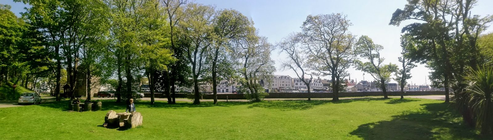
Monday 29th May to Inverness
On Monday we made our way to Inverness on the morning bus, which took only one and half hours! We had a longish wait in Inverness for the sleeper’s departure for London but it was another warm and sunny day and we were able to leave our luggage in lockers at the station while we explored the town. Although we had visited Inverness several times before, we formed a much better impression of it this time – there were new pedestrianised streets in the centre and the park area around the castle was a pleasant place to sit and eat our picnic lunch. The sleeper departure was on time as was our rendezvous before departure with the courier van contracted by Caledonian Sleeper to carry several bicycles concurrently to London because there was insufficient space for them on the train.
We have used sleeper trains a lot in the UK and in Europe so we managed to sleep through the rather rattling journey on this old train (due to be replaced with brand new ones next year). Arrival into Euston was delayed by over an hour due to problems at the station so we received a prompt and welcome refund on our southbound tickets from Caledonian Sleeper.
See our album of photos taken on this trip on Google Photos